
Kolkerheide
| coat of arms | Germany map | |
|---|---|---|

|
Coordinates: 54 ° 37 ' N , 9 ° 8' E |
|
| Basic data | ||
| State : | Schleswig-Holstein | |
| Circle : | North Friesland | |
| Office : | Central North Friesland | |
| Height : | 16 m above sea level NHN | |
| Area : | 2.1 km 2 | |
| Residents: | 63 (Dec. 31, 2019) | |
| Population density : | 30 inhabitants per km 2 | |
| Postal code : | 25862 | |
| Area code : | 04673 | |
| License plate : | NF | |
| Community key : | 01 0 54 071 | |
| Office administration address: | Theodor-Storm-Strasse 2 25821 Bredstedt, Germany |
|
| Website : | ||
| Mayor : | Hans-Günther Thordsen | |
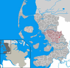
| Location of the community Kolkerheide in the district of North Friesland | ||
  |
||

Kolkerheide ( Danish : Kolkhede , also Kolkærhede , Jutland : Kåldtjer'hie , North Frisian : Kolkerhii ) is a municipality in the district of North Friesland in Schleswig-Holstein . Rantzauen-Hof, Buchwalden-Hof, Raben-Hof, Rumohrs-Hof and Osten-Hof are in the municipality.
geography
Geographical location
The municipality of Kolkerheide is located in the west of the Schleswigsche Geest landscape between Bredstedt and Viöl . Historically it was part of the Nordergoesharde . The Ostau river forms the southern boundary of the municipality with Drelsdorf and Norstedt.
Neighboring communities
The following municipal areas border on Kolkerheide:
| Joldelund | ||
| Joldelund |
.svg)
|
Löwenstedt |
| Drelsdorf | Norstedt |
history
The place name was first documented in 1499 and means heath of Koldkær . As the Danish dialect form shows, a field name ( Koldkjær or Koldkær ) means cold break , cold Kratt to Danish. kold and kær (for wetland or marshland). An interpretation too Old Norse kol for coal is also possible . Maybe coal was extracted here.
The place is traditionally part of the parish Joldelund ( Joldelund Sogn ). Until the German-Danish War in 1864, the place was part of the Duchy of Schleswig as a fiefdom of the Kingdom of Denmark .
On April 1, 1934, the parish county Joldelund was dissolved. All of their village communities, village communities and farmers became independent communities / rural communities, including Kolkerheide.
politics
Community representation
Since the community has less than 70 inhabitants, it has a community assembly instead of a community council. This includes all citizens of the municipality who are entitled to vote.
mayor
Hans-Günther Thordsen was re-elected mayor for the 2013-2018 electoral term.
coat of arms
Blazon : “Divided by green and gold with five small counterpimples on the left. Above a golden beehive, below a black beef head. "
Economy and Infrastructure
General
The municipality is predominantly agricultural. However, many companies are slowly dying out due to the economic situation. At most of the farms, the new generation will not take over the family business.
traffic
Kolkerheide is located away from the federal trunk road network in a strongly rural area. The village is mainly connected by car via the state road 281 between Haselund and Goldebek, which runs through the village . The transition to federal highway 200 is in Haselund . There is also an alternative cross connection to the L 28, which runs further south, between Bredstedt (transition to federal highway 5 ) and Viöl (B 200).
In the local public transport , Kolkerheide is connected to Flensburg and Bredstedt via the regional bus route R125 with the rail traffic there on the Flensburg – Neumünster and the Marschbahn . In addition, the community is integrated into the Joldelund on-call bus area .
Web links
Individual evidence
- ↑ North Statistics Office - Population of the municipalities in Schleswig-Holstein 4th quarter 2019 (XLSX file) (update based on the 2011 census) ( help on this ).
- ↑ Johannes Kok: Det danske folkesprog i Sønderjylland , Volume 2, København 1867, p. 232
- ↑ Wolfgang Laur: Historisches Ortsnamelexikon von Schleswig-Holstein , 2nd edition, Neumünster 1992, p. 402
- ↑ Schleswig-Holstein topography. Vol. 5: Holt - Krokau . 1st edition Flying-Kiwi-Verl. Junge, Flensburg 2005, ISBN 978-3-926055-79-8 , pp. 305 ( dnb.de [accessed on July 20, 2020]).
- ↑ Wolfgang Laur: Historisches Ortsnamelexikon von Schleswig-Holstein , 2nd edition, Neumünster 1992, p. 402
- ↑ Johannes Kok: Det danske folkesprog i Sønderjylland , Volume 2, København 1867, p. 232
- ↑ State Statistical Office Schleswig-Holstein (ed.): The population of the communities in Schleswig-Holstein 1867 - 1970 . State Statistical Office Schleswig-Holstein, Kiel 1972, p. 251 .
- ↑ Schleswig-Holstein's municipal coat of arms
- ↑ Flyer on the Joldelund on-call bus area. (pdf) Retrieved November 3, 2019 .
Achtrup | Ahrenshöft | Ahrenviöl | Ahrenviölfeld | Alkersum | Almdorf | Arlewatt | Aventoft | Bargum | Behrendorf | Bohmstedt | Bondelum | Bordelum | Borgsum | Bosbull | Braderup | Bramstedtlund | Bredstedt | Breklum | Dagebüll | Drage | Drelsdorf | Dunsum | Elisabeth-Sophien-Koog | Ellhöft | Emmelsbüll-Horsbüll | Narrow Sands | Fresendelf | Friedrich-Wilhelm-Lübke-Koog | Friedrichstadt | Galmsbüll | Garding | Garding, parish | Goldebek | Goldelund | Gröde | Grothusenkoog | Haselund | Hattstedt | Hattstedtermarsch | Högel | Spar | Hooge | Hörnum (Sylt) | Horstedt | Hude | Humptrup | Husum | Immenstedt | Joldelund | Kampen (Sylt) | Karlum | Katharinenheerd | Klanxbüll | Klixbull | Koldenbüttel | Kolkerheide | Kotzenbüll | Ladelund | Langeneß | Langenhorn | Leak | Lexgaard | List on Sylt | Löwenstedt | Lütjenholm | Midlum | Mildstedt | Fog | Neukirchen | Nieblum | Niebüll | Norddorf on Amrum | Norderfriedrichskoog | North beach | Norstedt | Ockholm | Oevenum | Oldenswort | Oldersbek | Olderup | Oldsum | Ostenfeld (Husum) | Oster-Ohrstedt | Osterhever | Pellworm | Poppenbüll | Ramstedt | Rantrum | Reußenköge | Risum-Lindholm | Rodenäs | Sankt Peter-Ording | Schwabstedt | Schwesing | Seeth | Simonsberg | Sollwitt | Sönnebüll | Sprakebull | Stadum | Stedesand | Struckum | South end | Süderhöft | Süderlügum | South March | Sylt | Tating | Tetenbull | Tinningstedt | Tönning | Tümlauer-Koog | Uelvesbüll | Uphusum | Utersum | Viöl | Vollerwiek | Vollstedt | World | Wenningstedt-Braderup (Sylt) | Wester-Ohrstedt | Westerhever | Westre | Winnert | Wipe | Witsum | Wittbek | Wittdün on Amrum | Joke word | Wobbenbüll | Wrixum | Wyk on Föhr