
Borgsum
| coat of arms | Germany map | |
|---|---|---|

|
Coordinates: 54 ° 42 ′ N , 8 ° 28 ′ E |
|
| Basic data | ||
| State : | Schleswig-Holstein | |
| Circle : | North Friesland | |
| Office : | Foehr-Amrum | |
| Height : | 5 m above sea level NHN | |
| Area : | 5.51 km 2 | |
| Residents: | 336 (Dec. 31, 2019) | |
| Population density : | 61 inhabitants per km 2 | |
| Postal code : | 25938 | |
| Area code : | 04683 | |
| License plate : | NF | |
| Community key : | 01 0 54 015 | |
| LOCODE : | DE 76B | |
| Office administration address: | Hafenstrasse 23 25938 Wyk auf Föhr |
|
| Website : | ||
| Mayor : | Norbert Nielsen | |
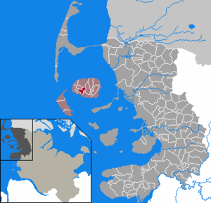
| Location of the municipality of Borgsum in the district of North Friesland | ||
  |
||

Borgsum ( Frisian : Borigsem ) is a municipality on the island of Föhr , which belongs to the district of North Friesland in Schleswig-Holstein . Five Aussiedlerhöfe are in the municipality.
geography
Geographical location
The municipality of Borgsum extends in the south of the Föhrer Marschkoog at the transition to the narrow strip of land to the south of the Geest in the western part of the North Frisian island of Föhr .
Neighboring communities
Adjacent municipal areas are:
| South end | Oldsum | Alkersum |
| Oldsum |
.svg)
|
|
| Witsum | Nieblum |
history
The place name means settlement at the castle . The Lembecksburg is meant . It is a 10 m high ring wall with a diameter of 95 m, which was built in the 9th century to protect against the Vikings . The castle was named after the knight Klaus Lembeck, who is said to have resided here in the 14th century as governor of the Danish King Waldemar IV . After breaking the feudal oath he is said to have been besieged there by the king's army. According to other information, Lembeck never set foot on the island. Borgsum was first mentioned in a document in 1462.
In 1991 a windmill was built in place of a dilapidated one.
politics
Of the nine seats in the municipal council, the Borgsum voter community (BWG) has eight seats since the 2018 local elections , and one more is held by an individual applicant .
economy
Borgsum is characterized by agriculture and tourism. There are also some craft businesses.
Borgsum has the only bowling alley on the island.
Web links
Individual evidence
- ↑ North Statistics Office - Population of the municipalities in Schleswig-Holstein 4th quarter 2019 (XLSX file) (update based on the 2011 census) ( help on this ).
- ↑ Schleswig-Holstein topography. Vol. 2: Boren - Ellerau . 1st edition Flying-Kiwi-Verl. Junge, Flensburg 2002, ISBN 978-3-926055-68-2 , p. 12 ( dnb.de [accessed June 11, 2020]).
- ↑ Schleswig-Holstein topography. Vol. 2: Boren - Ellerau . 1st edition Flying-Kiwi-Verl. Junge, Flensburg 2002, ISBN 978-3-926055-68-2 , p. 12 ( dnb.de [accessed June 12, 2020]).
- ^ Föhr-Land: communities of voters in front. In: Der Insel-Bote from May 7, 2018, accessed on May 9, 2018


Achtrup | Ahrenshöft | Ahrenviöl | Ahrenviölfeld | Alkersum | Almdorf | Arlewatt | Aventoft | Bargum | Behrendorf | Bohmstedt | Bondelum | Bordelum | Borgsum | Bosbull | Braderup | Bramstedtlund | Bredstedt | Breklum | Dagebüll | Drage | Drelsdorf | Dunsum | Elisabeth-Sophien-Koog | Ellhöft | Emmelsbüll-Horsbüll | Narrow Sands | Fresendelf | Friedrich-Wilhelm-Lübke-Koog | Friedrichstadt | Galmsbüll | Garding | Garding, parish | Goldebek | Goldelund | Gröde | Grothusenkoog | Haselund | Hattstedt | Hattstedtermarsch | Högel | Spar | Hooge | Hörnum (Sylt) | Horstedt | Hude | Humptrup | Husum | Immenstedt | Joldelund | Kampen (Sylt) | Karlum | Katharinenheerd | Klanxbüll | Klixbull | Koldenbüttel | Kolkerheide | Kotzenbüll | Ladelund | Langeneß | Langenhorn | Leak | Lexgaard | List on Sylt | Löwenstedt | Lütjenholm | Midlum | Mildstedt | Fog | Neukirchen | Nieblum | Niebüll | Norddorf on Amrum | Norderfriedrichskoog | North beach | Norstedt | Ockholm | Oevenum | Oldenswort | Oldersbek | Olderup | Oldsum | Ostenfeld (Husum) | Oster-Ohrstedt | Osterhever | Pellworm | Poppenbüll | Ramstedt | Rantrum | Reußenköge | Risum-Lindholm | Rodenäs | Sankt Peter-Ording | Schwabstedt | Schwesing | Seeth | Simonsberg | Sollwitt | Sönnebüll | Sprakebull | Stadum | Stedesand | Struckum | South end | Süderhöft | Süderlügum | South March | Sylt | Tating | Tetenbull | Tinningstedt | Tönning | Tümlauer-Koog | Uelvesbüll | Uphusum | Utersum | Viöl | Vollerwiek | Vollstedt | World | Wenningstedt-Braderup (Sylt) | Wester-Ohrstedt | Westerhever | Westre | Winnert | Wipe | Witsum | Wittbek | Wittdün on Amrum | Joke word | Wobbenbüll | Wrixum | Wyk on Föhr