
Wittbek
| coat of arms | Germany map | |
|---|---|---|

|
Coordinates: 54 ° 28 ' N , 9 ° 12' E |
|
| Basic data | ||
| State : | Schleswig-Holstein | |
| Circle : | North Friesland | |
| Office : | North Sea Treene | |
| Height : | 25 m above sea level NHN | |
| Area : | 19.91 km 2 | |
| Residents: | 768 (Dec. 31, 2019) | |
| Population density : | 39 inhabitants per km 2 | |
| Postal code : | 25872 | |
| Area code : | 04845 | |
| License plate : | NF | |
| Community key : | 01 0 54 159 | |
| Office administration address: | Schulweg 19 25866 Mildstedt |
|
| Website : | ||
| Mayor : | Barbara Thomsen (A-AWG) | |
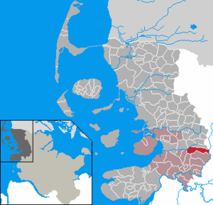
| Location of the community Wittbek in the district of North Friesland | ||
  |
||

Wittbek ( Danish : Vedbæk ) is a municipality on the Treene in the district of North Friesland in Schleswig-Holstein .
geography

The community is located in the middle of the Schleswig Geest on a ridge west of the Treene lowland. At a short distance beyond the southern municipality boundary , in the neighboring municipality of Ostenfeld, there is the Sandesberg , at 53.5 meters the highest point in the North Friesland district.
In addition to the main town, the districts of Osterwittbekfeld, Westerwittbekfeld and Sprüng are also located in the municipality.
history
Until the German-Danish War in 1864, the place was part of the Ostenfeld parish ( Østerfjolde Sogn ) within the Nordergoesharde in the Duchy of Schleswig, which belongs to Denmark . After the duchies of Schleswig and Holstein were annexed by Prussia , the parish was transformed into a parish county with the three villages of Ostenfeld, Winnert and Wittbek. On April 1, 1934, the parish land municipality Ostenfeld was dissolved. All of their village communities, village communities and farmers became independent communities / rural communities, including Wittbek and Winnert next to the main town of Ostenfeld .
According to Husumer Nachrichten , Adolf Hitler accepted Wittbek's honorary citizenship because the village had voted for the NSDAP five times in a row with all votes . In the meantime, honorary citizenship has been revoked.
Wittbek was first mentioned in 1423 as Widbeke . The place name is made up of the Danish word for Bach (Danish bæk , Niederdt. Bek ) and the Danish word for forest ( old Danish with , new Danish ved ) , which was adopted into Low German as Witt . The place name means something like Waldbach .
politics
Community representation
Of the eleven seats in the municipal council, the A-AWG electoral community had six seats since the 2008 local elections and the AWG two electoral community. In the local elections on May 26, 2013, the A-AWG received 53.8 percent of the votes cast and retained its six seats. The AWG came to 46.2 percent and got five seats. The turnout was 56.7 percent.
mayor
Johannes Heinrich Jürgensen (A-AWG) was re-elected mayor for the 2013–2018 election period.
coat of arms
Blazon : "Above a blue shield base in green, bordered by a narrow silver wave bar, an openwork silver wave bar, above it three golden leaves 1.5: 2, below a golden cow's head in front view."
Economy and Infrastructure
The municipality is largely agricultural. In addition, there are individual small businesses in the village. The closest shops are in the neighboring community of Ostenfeld.
traffic
The best way to get to the community is by motorized private transport. The North Frisian district road 143 , which leads from Husum to Ostenfeld, runs through the main town .
The public transport connection is made by a bus line operated by the Nordfriesland Regional Transport and Tariff Association . The travel time to Husum is just under half an hour. The bus runs every hour in the morning and every two hours in the afternoon. The responsible bus company is Autokraft .
Public facilities
The Treene Water Association has its headquarters in the municipality. He operates a waterworks in the Osterwittbekfeld district that supplies 46 communities in the surrounding area with drinking water. The supply area extends from the Hallig Südfall to the Schlei to Borgwedel ( Schleswig-Flensburg district ).
Preparatory studies for the development of the groundwater resources began in 1961 . The groundwater is located in a sandy to pebbly glacial aquifer that is up to 80 meters thick.
Culture and sights
A football club and a sports club are located on site. 1. FC Wittbek is a pure football club and has existed since 1983. TSV Ostenfeld-Wittbek-Winnert (TSV OWW) is particularly well-known for its handball division. There is a syndicate with the SZ Ohrstedt .
There is also art to see in Wittbek. The artist Solvej Krüger has housed a permanent art exhibition in her Kunstkieken workshop.
Web links
Individual evidence
- ↑ North Statistics Office - Population of the municipalities in Schleswig-Holstein 4th quarter 2019 (XLSX file) (update based on the 2011 census) ( help on this ).
- ↑ a b Schleswig-Holstein topography. Vol. 10: Timmaspe - Ziethen . 1st edition Flying-Kiwi-Verl. Junge, Flensburg 2008, ISBN 978-3-926055-92-7 , p. 329 ( dnb.de [accessed on August 9, 2020]).
- ↑ State Statistical Office Schleswig-Holstein (Ed.): The population of the communities in Schleswig-Holstein 1867-1970 . State Statistical Office Schleswig-Holstein, Kiel 1972, p. 251 .
- ↑ hem: Unanimous decision: Wittbek recognizes Hitler's honorary citizenship | shz.de. Retrieved August 9, 2020 .
- ↑ Wolfgang Laur: Historisches Ortsnamelexikon von Schleswig-Holstein , 2nd edition, Neumünster 1992, p. 704
- ^ Result of Wittbek local elections 2013
- ↑ Schleswig-Holstein's municipal coat of arms
- ^ Community information at the North Sea-Treene office. Accessed April 30, 2020 .
Achtrup | Ahrenshöft | Ahrenviöl | Ahrenviölfeld | Alkersum | Almdorf | Arlewatt | Aventoft | Bargum | Behrendorf | Bohmstedt | Bondelum | Bordelum | Borgsum | Bosbull | Braderup | Bramstedtlund | Bredstedt | Breklum | Dagebüll | Drage | Drelsdorf | Dunsum | Elisabeth-Sophien-Koog | Ellhöft | Emmelsbüll-Horsbüll | Narrow Sands | Fresendelf | Friedrich-Wilhelm-Lübke-Koog | Friedrichstadt | Galmsbüll | Garding | Garding, parish | Goldebek | Goldelund | Gröde | Grothusenkoog | Haselund | Hattstedt | Hattstedtermarsch | Högel | Spar | Hooge | Hörnum (Sylt) | Horstedt | Hude | Humptrup | Husum | Immenstedt | Joldelund | Kampen (Sylt) | Karlum | Katharinenheerd | Klanxbüll | Klixbull | Koldenbüttel | Kolkerheide | Kotzenbüll | Ladelund | Langeneß | Langenhorn | Leak | Lexgaard | List on Sylt | Löwenstedt | Lütjenholm | Midlum | Mildstedt | Fog | Neukirchen | Nieblum | Niebüll | Norddorf on Amrum | Norderfriedrichskoog | North beach | Norstedt | Ockholm | Oevenum | Oldenswort | Oldersbek | Olderup | Oldsum | Ostenfeld (Husum) | Oster-Ohrstedt | Osterhever | Pellworm | Poppenbüll | Ramstedt | Rantrum | Reußenköge | Risum-Lindholm | Rodenäs | Sankt Peter-Ording | Schwabstedt | Schwesing | Seeth | Simonsberg | Sollwitt | Sönnebüll | Sprakebull | Stadum | Stedesand | Struckum | South end | Süderhöft | Süderlügum | South March | Sylt | Tating | Tetenbull | Tinningstedt | Tönning | Tümlauer-Koog | Uelvesbüll | Uphusum | Utersum | Viöl | Vollerwiek | Vollstedt | World | Wenningstedt-Braderup (Sylt) | Wester-Ohrstedt | Westerhever | Westre | Winnert | Wipe | Witsum | Wittbek | Wittdün on Amrum | Joke word | Wobbenbüll | Wrixum | Wyk on Föhr