
Klixbull
| coat of arms | Germany map | |
|---|---|---|

|
Coordinates: 54 ° 48 ' N , 8 ° 53' E |
|
| Basic data | ||
| State : | Schleswig-Holstein | |
| Circle : | North Friesland | |
| Office : | Südtondern | |
| Height : | 4 m above sea level NHN | |
| Area : | 17.44 km 2 | |
| Residents: | 1005 (Dec. 31, 2019) | |
| Population density : | 58 inhabitants per km 2 | |
| Postal code : | 25899 | |
| Primaries : | 04661, 04662 | |
| License plate : | NF | |
| Community key : | 01 0 54 068 | |
| Office administration address: | Marktstrasse 12 25899 Niebüll |
|
| Website : | ||
| Mayor : | Werner Schweizer (KWG) | |
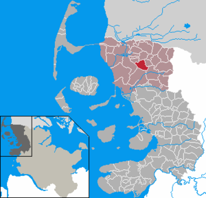
| Location of the municipality of Klixbüll in the district of North Friesland | ||
  |
||

Klixbüll ( Danish : Klægsbøl , North Frisian : Klasbel ) is a municipality in the district of North Friesland in Schleswig-Holstein .
The noble estates of Klixbüllhof and Karrhardehof are located in the municipality. Since Bosbüll , Karlum , Leck-Ründel and Tinningstedt were branch estates of Klixbüllhof, there is still a close connection between the five communities today.
geography
Geographical location
The municipality of Klixbüll is located on both sides of the transition from the Lecker Geest , a weakly relief sand formation north-east of Niebüll, to the north-west bordering North Frisian Marsch . The marshland was due to its location close to the beach in the protection of the large sand island Risummoor, one of the first areas in what is now the district of North Friesland to be diked . The land was fortified by the construction of the dike in 1466 by the neighboring residents in order to improve the settlement conditions of the village. The dyke line that was drawn at that time still represents the road connection to federal highway 5 today . From the B 5 in Klixbüll, the state road 3 goes to Ladelund .
The northern Geestland was farmed as a common land until 1723 . The west of the village was not dyed- proof until 1566 when the so-called Gotteskoog was dyed.
Community structure
The following additional settlements are located within the municipality:
- Klixbüllhof
- Klixbüll Church
- Klixbüllfeld
- Wraagaard
Neighboring communities
Adjacent municipal areas of Klixbüll are:
| Bosbull | Braderup | Tinningstedt |
.svg)
|
leak | |
| Niebüll | Risum-Lindholm |
history
.jpg)
Klixbüll was first mentioned in a document in 1352, but can be found by name in church lists as early as 1300. The St. Nicholas Church was built around 1100 and was last restored in 2010. Around 1460 it was one of the main churches of the Karrharde . Flood marks from 1532 ( All Saints Flood 1532 ) and 1634 ( Burchardi Flood ) can be found on its tower . The oldest building in the village is located on a hill next to the church, the core of the former Klixbüllhof estate.
At the point where the Bundesstrasse 199 runs through the town today, there was an outer dike until 1466, where Klixbüll first grew as a Geest village , until the Gotteskooge dike in 1566 as a marshland village .
During the Thirty Years War , Swedish troops built a powder tower in the village, but it was later destroyed. In its place was the Pulverturm restaurant until 1955.
politics
Community representation
The local elections on May 6, 2018 had the following result: KWG voter community all eleven seats. The turnout was last 51.3 percent.
mayor
Werner Schweizer (KWG) was elected mayor for the 2018–2023 election period. In 2013 he succeeded Peter Friedrich Carstensen.
coat of arms
Blazon : "In blue a growing golden braided fence, above a silver square tower with a surrounding crenellated crown and red pointed roof, accompanied on both sides by a golden ear."
economy
The municipality is predominantly agricultural.
Sons and daughters of the church
- Nicolaus Ludwig Esmarch (1654–1719), poet and theologian
- Hieronymus Kamphövener (1757–1824), administrative lawyer in the Danish service
- Broder Christiansen (1869–1958), philosopher and linguist
literature
- Municipality of Klixbüll: village chronicle of Klixbüll, municipality of Klixbüll, 1A 1997.
- Harry Kunz, Albert Panten: The Köge of North Frisia. Nordfriisk Instituut, Bredstedt 1997, ISBN 3-88007-251-5 .
Web links
Individual evidence
- ↑ North Statistics Office - Population of the municipalities in Schleswig-Holstein 4th quarter 2019 (XLSX file) (update based on the 2011 census) ( help on this ).
- ↑ Nordfriesland map , Nordfriisk Instituut, Bräist / Bredstedt 2011, ISBN 978-3-88007-371-5
- ^ Housing directory Schleswig-Holstein 1987. (pdf) State Statistical Office Schleswig-Holstein, accessed on February 3, 2019 .
- ↑ Web editor: Results of the 2018 municipal elections in the South Tondern office. In: www.amt-suedtondern.de. Office Südtondern, accessed on July 6, 2018 .
- ↑ Werner Schweizer remains mayor of Nordfriesland Tageblatt from June 19, 2018, accessed on July 6, 2018
- ↑ Schleswig-Holstein's municipal coat of arms
Achtrup | Ahrenshöft | Ahrenviöl | Ahrenviölfeld | Alkersum | Almdorf | Arlewatt | Aventoft | Bargum | Behrendorf | Bohmstedt | Bondelum | Bordelum | Borgsum | Bosbull | Braderup | Bramstedtlund | Bredstedt | Breklum | Dagebüll | Drage | Drelsdorf | Dunsum | Elisabeth-Sophien-Koog | Ellhöft | Emmelsbüll-Horsbüll | Narrow Sands | Fresendelf | Friedrich-Wilhelm-Lübke-Koog | Friedrichstadt | Galmsbüll | Garding | Garding, parish | Goldebek | Goldelund | Gröde | Grothusenkoog | Haselund | Hattstedt | Hattstedtermarsch | Högel | Spar | Hooge | Hörnum (Sylt) | Horstedt | Hude | Humptrup | Husum | Immenstedt | Joldelund | Kampen (Sylt) | Karlum | Katharinenheerd | Klanxbüll | Klixbull | Koldenbüttel | Kolkerheide | Kotzenbüll | Ladelund | Langeneß | Langenhorn | Leak | Lexgaard | List on Sylt | Löwenstedt | Lütjenholm | Midlum | Mildstedt | Fog | Neukirchen | Nieblum | Niebüll | Norddorf on Amrum | Norderfriedrichskoog | North beach | Norstedt | Ockholm | Oevenum | Oldenswort | Oldersbek | Olderup | Oldsum | Ostenfeld (Husum) | Oster-Ohrstedt | Osterhever | Pellworm | Poppenbüll | Ramstedt | Rantrum | Reußenköge | Risum-Lindholm | Rodenäs | Sankt Peter-Ording | Schwabstedt | Schwesing | Seeth | Simonsberg | Sollwitt | Sönnebüll | Sprakebull | Stadum | Stedesand | Struckum | South end | Süderhöft | Süderlügum | South March | Sylt | Tating | Tetenbull | Tinningstedt | Tönning | Tümlauer-Koog | Uelvesbüll | Uphusum | Utersum | Viöl | Vollerwiek | Vollstedt | World | Wenningstedt-Braderup (Sylt) | Wester-Ohrstedt | Westerhever | Westre | Winnert | Wipe | Witsum | Wittbek | Wittdün on Amrum | Joke word | Wobbenbüll | Wrixum | Wyk on Föhr