
Oldersbek
| coat of arms | Germany map | |
|---|---|---|

|
Coordinates: 54 ° 27 ' N , 9 ° 10' E |
|
| Basic data | ||
| State : | Schleswig-Holstein | |
| Circle : | North Friesland | |
| Office : | North Sea Treene | |
| Height : | 11 m above sea level NHN | |
| Area : | 10.82 km 2 | |
| Residents: | 739 (Dec. 31, 2019) | |
| Population density : | 68 inhabitants per km 2 | |
| Postal code : | 25873 | |
| Area code : | 04848 | |
| License plate : | NF | |
| Community key : | 01 0 54 096 | |
| LOCODE : | DE OB8 | |
| Office administration address: | Schulweg 19 25866 Mildstedt |
|
| Website : | ||
| Mayor : | Hans-Joachim Müller (AAWO) | |
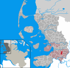
| Location of the municipality of Oldersbek in the district of North Friesland | ||
  |
||

Oldersbek ( Danish : Oldersbæk) is a municipality in the district of North Friesland in Schleswig-Holstein . Oldersbekfeld, Steinberg and Kohlschau are in the municipality.
geography
Oldersbek is about eight kilometers southeast of Husum .
history
A prehistoric settlement of the region is documented by megalithic tombs .
On April 1, 1934, the parish land community Mildstedt was dissolved. All of their village communities, village communities and farmers became independent communities / rural communities, including Oldersbek.
politics
Community representation
Of the nine seats in the municipal council, the AAWO community of voters had five seats since the 2008 local elections and the WAO community of voters four. In the local elections on May 26, 2013, the AAWO received 57.5 percent of the votes cast, the WAO received 42.5 percent. Nothing changed in the distribution of seats. The turnout was 60.6 percent.
The local elections on May 6, 2018 resulted in an overall turnout of 68.6%. With 65.1% of the votes cast, the AAWO received six seats in the municipal council. The WAO came to 34.9% and received three seats in the community council.
mayor
Hans-Joachim Müller (AAWO) was re-elected for the 2013–2018 election period.
Hans-Joachim Müller (AAWO) was also re-elected for the 2018–2023 election period.
coat of arms
Blazon : “Divided by gold and green. Above a black stone grave consisting of three bearing stones and a capstone, below an obliquely left silver wave bar. "
economy
The municipality is predominantly agricultural. There are also several wind turbines in the outer area of the municipality to the north of the town center .
Web links
Individual evidence
- ↑ North Statistics Office - Population of the municipalities in Schleswig-Holstein 4th quarter 2019 (XLSX file) (update based on the 2011 census) ( help on this ).
- ↑ Schleswig-Holstein topography. Vol. 7: Munkbrarup - Pohnsdorf . 1st edition Flying-Kiwi-Verl. Junge, Flensburg 2006, ISBN 978-3-926055-88-0 , p. 260 ( dnb.de [accessed on July 22, 2020]).
- ↑ State Statistical Office Schleswig-Holstein (Ed.): The population of the communities in Schleswig-Holstein 1867-1970 . State Statistical Office Schleswig-Holstein, Kiel 1972, p. 251 .
- ^ Result of the Oldersbek local election 2013
- ↑ Result Oldersbek KW 2018 constituency 1. Accessed on February 5, 2019 .
- ↑ Schleswig-Holstein's municipal coat of arms
Achtrup | Ahrenshöft | Ahrenviöl | Ahrenviölfeld | Alkersum | Almdorf | Arlewatt | Aventoft | Bargum | Behrendorf | Bohmstedt | Bondelum | Bordelum | Borgsum | Bosbull | Braderup | Bramstedtlund | Bredstedt | Breklum | Dagebüll | Drage | Drelsdorf | Dunsum | Elisabeth-Sophien-Koog | Ellhöft | Emmelsbüll-Horsbüll | Narrow Sands | Fresendelf | Friedrich-Wilhelm-Lübke-Koog | Friedrichstadt | Galmsbüll | Garding | Garding, parish | Goldebek | Goldelund | Gröde | Grothusenkoog | Haselund | Hattstedt | Hattstedtermarsch | Högel | Spar | Hooge | Hörnum (Sylt) | Horstedt | Hude | Humptrup | Husum | Immenstedt | Joldelund | Kampen (Sylt) | Karlum | Katharinenheerd | Klanxbüll | Klixbull | Koldenbüttel | Kolkerheide | Kotzenbüll | Ladelund | Langeneß | Langenhorn | Leak | Lexgaard | List on Sylt | Löwenstedt | Lütjenholm | Midlum | Mildstedt | Fog | Neukirchen | Nieblum | Niebüll | Norddorf on Amrum | Norderfriedrichskoog | North beach | Norstedt | Ockholm | Oevenum | Oldenswort | Oldersbek | Olderup | Oldsum | Ostenfeld (Husum) | Oster-Ohrstedt | Osterhever | Pellworm | Poppenbüll | Ramstedt | Rantrum | Reußenköge | Risum-Lindholm | Rodenäs | Sankt Peter-Ording | Schwabstedt | Schwesing | Seeth | Simonsberg | Sollwitt | Sönnebüll | Sprakebull | Stadum | Stedesand | Struckum | South end | Süderhöft | Süderlügum | South March | Sylt | Tating | Tetenbull | Tinningstedt | Tönning | Tümlauer-Koog | Uelvesbüll | Uphusum | Utersum | Viöl | Vollerwiek | Vollstedt | World | Wenningstedt-Braderup (Sylt) | Wester-Ohrstedt | Westerhever | Westre | Winnert | Wipe | Witsum | Wittbek | Wittdün on Amrum | Joke word | Wobbenbüll | Wrixum | Wyk on Föhr