List of extreme points in Germany
Northern, eastern, southern and westernmost point in Germany |
The different centers of Germany |
The highest and lowest places in Germany |
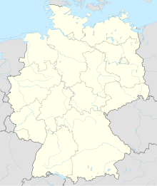
The list of extreme points in Germany indicates where the northernmost, easternmost, southernmost and westernmost as well as the highest and lowest point of the German national territory are located, and describes how the different midpoints were determined.
geography
Geographical extreme points
- North:
- Northernmost point of the maritime border (territory): 55 ° 5 ′ 4.6 ″ N , 8 ° 19 ′ 2.6 ″ E
- Northernmost land point: Peninsula Ellenbogen near List on Sylt , Schleswig-Holstein : 55 ° 3 ′ 31.1 ″ N , 8 ° 25 ′ 3.1 ″ E
- Northernmost land point on the mainland: Rodenäs , Südtondern , North Frisia , Schleswig-Holstein: 54 ° 54 ′ 40.7 ″ N , 8 ° 40 ′ 14.2 ″ E
- South: "Grenzstein 147" at Haldenwanger Eck in the municipality of Oberstdorf , Bavaria : 47 ° 16 ′ 18 ″ N , 10 ° 10 ′ 26.6 ″ E
- West: At the Groevenkamp house in Isenbruch , Selfkant municipality , North Rhine-Westphalia : 51 ° 3 ′ 9 ″ N , 5 ° 52 ′ 1 ″ E
- East: In the municipality of Neißeaue , district of Görlitz , Saxony , between the districts of Deschka and Zentendorf, the Lausitzer Neisse makes an arc where the easternmost point of Germany is: 51 ° 16 ′ 22 ″ N , 15 ° 2 ′ 37 ″ E
Midpoints
There are different locations at the center of Germany, depending on the method of determination
- If you connect the northernmost point with the southernmost and the easternmost with the westernmost, the lines cross in Besse in Hesse,
eastern longitude 9 ° 23 ′ 15 ″ northern latitude 51 ° 13 ′ 19 ″ - If the most distant points of the German national territory are chosen in north-south and east-west direction, you get a point about 500 meters north of Niederdorla in Thuringia,
east longitude 10 ° 27 ', north latitude 51 ° 10' - If you choose the center of gravity of the land mass of Germany, this point is in Landstreit near Eisenach in Thuringia,
east longitude 10 ° 20 ′ 14 ″ north latitude 51 ° 0 ′ 20 ″ - If the German water bodies are taken into account, the point in Silberhausen in Thuringia lies
east longitude 10 ° 20 ′ north latitude 51 ° 19 ′ - The maximum distance to the national borders is in Heiligenstadt in Thuringia,
east longitude 10 ° 8 ′ north latitude 51 ° 23 ′ - The center of the population is in Spangenberg in Hesse
east longitude 9 ° 39 ′ north latitude 51 ° 7 ′
ups and downs
Natural highs and lows
Maximum altitude: Zugspitze , Bavaria, 2962 m (47 ° 25 ′ 16 north, 10 ° 59 ′ 11 east)
Minimum altitude: Neuendorf near Wilster , Schleswig-Holstein, −3.54 m (53 ° 57 ′ 48 north, 9 ° 19 ′ 5 east)
Deepest lake in Germany: Lake Constance 254 m
Artificial elevations and depressions
The deepest artificial point is the Hambach opencast mine in North Rhine-Westphalia about 370 m below the local ground level, corresponding to about 270 m below sea level (50 ° 54 ′ 39 ″ north, 6 ° 30 ′ 10 ″ east). Therefore, this point is also the deepest open point Germany.
The highest artificial elevation is the Sophienhöhe , which is adjacent to the Hambach opencast mine, with a difference of 218 m relative to the surroundings (50 ° 55 ′ 55 ″ north, 6 ° 26 ′ 56 ″ east)
If you add the two height differences together, you get a difference of around 590 m, one of the largest artificial, open height differences in the world.
See also
- Pointed collar
- List of geographical centers
- Population center #list of population centers
- Center of Europe
Web links
Individual evidence
- ↑ [1] Chapter 1 Geography and Climate from the Statistical Yearbook 2014, page 13
- ↑ Theoretically, it is the only place in Germany that is in the time zone GMT + 1 (winter) ( WOZ ). Although the sun rises here more than an hour earlier than in London, the CET defined for Germany naturally also applies here , which deviates from the actual time zone (GMT) by one hour.
- ↑ [2] Chapter 1 Geography and Climate from the Statistical Yearbook 2014, page 14
- ↑ [3] Chapter 1 Geography and Climate from the Statistical Yearbook 2014, page 16
- ^ Information from RWE on the Hambach opencast mine.Retrieved on November 1, 2015
- ↑ Sophienhöhe, altitude
