
Rømø
| Rømø | |
|---|---|
 |
|
| Waters | German Bight , North Sea |
| Archipelago | Danish Wadden Islands |
| Geographical location | 55 ° 8 ′ N , 8 ° 31 ′ E |
 |
|
| length | 16.8 km |
| width | 5.7 km |
| surface | 128.86 km² |
| Highest elevation | Høstbjerg 19 m |
| Residents | 559 (January 1, 2020) 4.3 inhabitants / km² |
| main place | Havneby |
 |
|
Rømø [ ˈrœmʏː ] ( ), German Röm [ ˈrœm ] ( ) and North Frisian Rem [ ˈɾɛm ] ( ) is the southernmost Danish Wadden Sea island . It is located about six kilometers south of the island of Mandø and three kilometers north of Sylt . Rømø is a popular holiday destination with its kilometer-wide passable sandy beach.
geography


The 128.86 km² island has 559 inhabitants (as of January 1, 2020) and is connected to the mainland via the Rømødæmningen ( German : Röm Dam ).
However, the area of the island cannot be specified precisely because the boundary between sea and land is blurred. It is somewhere between 120 and 140 km². About 60 percent of the island is overgrown with plants, 40 percent are sandy areas.
In the north the length of the island is limited by the Juvredyb Juvre Deep , in the south by the 2.5 km wide and up to 40 meters deep Lister Deep . The core of the island consists of an approximately 25 km² crescent-shaped dune belt . In the direction of the open sea, the dunes are preceded by 25 km² salt meadows. As a result of the tidal current, large sand deposits ( Juvre Sand in the northwest, Havsand or German Haffsand in the southwest) with an area of over 40 km² have formed at the lows . The Havsand was until 1850 a separate, mostly dry sand at high tide island by a tidal creek was separated from Romo, but has since fully merged with the main island. From the sandbanks of the last 200 years has been over some new marshland formed with an area of about 10 square kilometers, of which 1867 and 1926/28 more than 600 hectares of diked were (marked on the map in bright green).
Every year Rømø continues to grow due to the sand carried off the west coast of Sylt by the winter storms. In the slipstream on the east coast of Rømø, an almost meter-thick, generally not stable, but concrete-hard layer of particularly fine-grained deposits in summer , which is threatened by erosion, since there is no large supply of sand here during storms.
Administrative division
From 1970 to the end of 2006 Rømø belonged to Skærbæk Kommune in Sønderjyllands Amt , and since the local reform on January 1, 2007 to Tønder Kommune in the Syddanmark region . Rømø forms its own parish municipality ( Danish : Sogn ) Rømø Sogn , which belonged to Harde Tønder, Højer og Lø Herred in Tønder Amt until the Danish municipal reform in 1970 .
When the island still belonged to the German district of Tondern , it was divided into three rural communities:
| local community | location | Area ( ha ) |
Population 1.12.1871 |
Population 1.12.1885 |
Population December 2nd, 1895 |
Population 1.12.1905 |
Population 1.12.1910 |
Population October 8, 1919 |
|---|---|---|---|---|---|---|---|---|
| Juvre | north | 3237 | 264 | 281 | 262 | 234 | 226 | 228 |
| Kirkeby | center | 3089 | 658 | 530 | 437 | 372 | 346 | 283 |
| Kongsmark | south | 1697 | 278 | 240 | 226 | 226 | 230 | 195 |
| Röm (island) | 8023 | ... | ... | ... | ... | ... | ... |
history
.jpg)

Rømø is first mentioned in writing as Rimme in 1190 . The island belonged to the St. Knud Monastery in Odense . In 1229 the Jutian island was listed as a crown property in King Waldemar's earth book . The island was superior to the Ellumssyssel . After 1290 the monastery in Ribe bought land on Rømø and subsequently gained influence. From 1544 to 1864 the southern part of the island ( Süderland , Danish Sønderlandet ) was a royal enclave and belonged to the Kingdom of Denmark . The northern part of the island ( Norderland ), however, was under the Schleswig Duke since 1544 .
The remains of the so-called Borrebjerg can still be seen in Østerby . It is a castle from the mid-14th century, its exact function is not yet understood. Historians suspect that it was built in connection with a defensive structure.
In the 16th century, seafaring became very important on the island; it temporarily took over the function of the deep sea port for the nearby Ribe, whose port was no longer accessible for large ships.
A turning point in the island's history was the Thirty Years War , during which Jutland and Rømø were occupied by imperial armies. The island was also hit by the great Burchardi flood in 1634.
In the 17th and 18th centuries, whaling brought great wealth to the barren island for the first time. In the heyday of whaling, Rømø had up to 40 commanders. Similar to the Frisian-populated islands, a large fire was lit on the beach every year on February 21 to say goodbye to the whaling ships. This Pers Awten (German: "Eve of Petertag") is also known as the Biikebrennen in North Friesland, south of the island . The almost complete extinction of the North Atlantic right whale and the continental barrier 1806-1811 soon led to economic stagnation; the men migrated to the Icelandic fishery. The population from around 1800 fell to 1534 by 1801 and to 1336 by 1860.
Between the German-Danish War in 1864 and the referendum in Schleswig in 1920, Rømø belonged as part of the Tondern district to the Prussian province of Schleswig-Holstein (from 1867) and thus to the German Empire (from 1871). Beach tourism started in 1898, but this could hardly slow down the emigration: in 1920 only 540 inhabitants lived on the island. The subsequent dyke construction promoted economic development. In the second half of the century, mass tourism, which began after the construction of Rømødæmningen , the road embankment to the mainland completed in 1948, led to an economic recovery.
Until the end of 2006 the island belonged to the Sønderjyllands Amt , today it belongs to the region Syddanmark (region Southern Denmark) like the rest of Northern Schleswig . The native language of most of the islanders is the regional South Jutian dialect (Rømømål). The residents also speak Imperial Danish and often High German.
Until the Second World War , there were no trees to speak of on Rømø. Stones had to be bought expensively from the mainland and brought to the island by ship. That is why in the 18th century construction was carried out with completely different and unusual raw materials: In Juvre in the north of the island you can still see the remainder of a fence made of whale jawbones from 1772. The whalebone fence was listed as a historical monument in 1977 and is the only remaining whalebone fence on the Danish and North Frisian Wadden Sea Islands.
The southern neighboring Hallig Jordsand sank in 2001 after being flooded by the North Sea in winter 1998/99.
Attractions
Rømø has some sights of national importance:
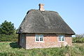
The Kommandørgården ("Kommandeurshof") is one of the old, rich hereditary estates of Rømø and was inhabited for a long time by the head of the island. The commander's yard is now one of the locations of the Danish National Museum . To the south of this is the Toftum Skole , Denmark's smallest and oldest school , as part of the site .
The Rømø Kirke , dating back to 1200, expanded in the 17th and 18th century, is the patron saint of sailors St. Clemens consecrated. There are several precious votive vessels inside . The church is surrounded by a cemetery with tombstones of rich whaling captains, so-called commander stones.
Havsand in the south and Juvre Sand in the north make up Northern Europe's largest sandy beach. At low tide it is around 4 km wide. In summer, numerous cars and camping vehicles are parked or run there (“Europe's largest parking lot”).
A whale skull bone is set up in an open area in the village of Kongsmark.
In the Tønnisgård Nature Center , an exhibition about the Wadden Sea and Rømø's nature and culture is shown all year round: there are stuffed seals and birds, a four-meter-long whale of a baleen whale , bones from one of the stranded sperm whales , a 2.2 kilogram weight Amber lumps and others. The nature center organizes, among other things, mudflat hikes and bunker tours.
Toftum Skole , the smallest and oldest school in Denmark

The whalebone fence in Juvre

Whale skull bones in Kongsmark


particularities

During the Second World War , the island was occupied by the Wehrmacht , who monitored the entire German Bight from there with an "Elephant Seal " radar device . Since British attacks on Rømø were feared, large bunkers were built , parts of which can be viewed as part of a guided tour. In the north there is a training area for the Danish Air Force , where you can watch the fighter-bombers from a viewing platform north of Juvre.
Most of the island's large state open spaces are freely accessible. Some areas are under nature protection. A special feature is that part of the beaches on the south and west side of the island can be freely driven by private car.
Rømø Havn was the location for the 2009 film The Ghostwriter by Roman Polański .
Economy and Transport
The largest place on the island is Havneby in the south of the island, a sub-center and at the same time the ferry port of the Rømø-Sylt-Linie , which is the only alternative to car loading via the Hindenburgdamm for vehicle transport to and from Sylt . The other places on the island are largely touristy and, in addition to holiday accommodation and campsites, have a few shops to meet daily needs. As early as the 1970s, when mass motorization began, over 700,000 tourists came to Rømø every year, but the hotel buildings here never reached the same dimensions as on Sylt. While around 60 farms were still being managed in 1960 and 34 in 1977, profitable agriculture is hardly possible today. The port of Havneby was not completed until 1964 with the aim of promoting fishing . The shrimp in Havneby is operated only since 1968th
The Juvredeich was destroyed by the storm surge of January 3, 1976 ; five shrimp cutters were destroyed in Havneby harbor and four damaged. On December 3, 1999, a storm surge hit the island hard.
Private transport
The island can be reached from the mainland via the toll-free Rømødæmningen ( German : Röm Dam ; length: 9170 m), which was completed in 1948 .
Bus / train
The island of Rømø is connected to the Sønderjylland public transport network by bus route 285 (Skærbæk – Rømø) operated by Sydtrafik . The closest train station is Skærbæk on the Danish part of the march railway . There, according to a regular timetable, Arriva regional trains run north ( Esbjerg via Ribe and Bramming) and south ( Tønder and Niebüll ). Until 1940 the island railway Rømø operated on the island, a 750-mm-gauge horse-drawn tram, which connected the harbor and ship terminal Kongsmark on the east side with the hotels and the bathing beach in Lakolk on the west side. After 1940 the rails were dismantled and sold. Relics of island rail traffic can no longer be found today.
ship
With the car and passenger ferry SyltExpress of the Rømø-Sylt-Linie you can cross from Havneby to List in the north of the island of Sylt. The journey takes around 40 minutes. The ferry connection is operated by the Förde Reederei Seetouristik based in Flensburg (FRS).


Flora and fauna
flora
The island has a rich flora that includes around 270 species of plants. There are different plant communities on the lake side, the inland with the heather and on the mudflat side. The salt-tolerant plants growing in the muddy side of the tidal flats such as samphire and lagoon rush are gradually being replaced towards the interior of the island by the sea meadow flora such as the carnation , which draws its water from the sweet groundwater.

Dune landscape in the west of the island
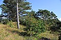
Heathland in the middle of the island


fauna

The island is the habitat of many animals. There are many seals on the sandbanks. The boys are born in July and August. In addition to rabbits, hares and roe deer, the island is home to many species of birds. Up to 95 bird species were counted in 2002. These include seagulls , eiders , shelducks , avocets , oystercatchers , curlews and sandpipers . Amphibians such as yellow-bellied toads and salamanders can also be found on the island.
In 1998, 87 species of mussels and snails were counted on the beach. There are also crabs , worms , sea urchins and other underwater organisms. After severe storms, large parts of the Havsand are covered by a layer of mussel shells.
In spring and autumn, the “ black sun ” is a natural phenomenon where very large flocks of starlings look for a resting place on their bird migration in the marshes. About an hour before sunset, these swarms usually gather in one place and darken the evening sky with their "air ballet".
Culture

Rømø Jazz
The jazz festival Rømø Jazz takes place annually on the first weekend in June.
Rømø Kite Festival
Every year on the first weekend in September there is an international kite festival where more than 1,000 kites fly.
Motorcycle meeting
A large motorcycle meeting takes place regularly at Pentecost .
Motor Festival
On the neighboring island of Fanö, car races took place in the form of sprints over a kilometer and a mile from 1919 to 1924. This tradition was revived on Rømø in 2016.
Regional cuisine
The regional cuisine is characterized by fish and seafood. Another specialty of the island is lamb from the salt meadow lamb. The regional South Jutian cuisine is also typical of the island.
Sports

Rømø on the southern stretch of the beach offers one of the most famous areas for sand sailing and buggy kiting in Europe. Use is free of charge.
There are horse riding opportunities, bike paths and in the south of the island a golf course designed as a links course .
literature
- Thilo Christophersen, Margarete Kragh: The North Sea island Röm. Nature, history, present . Tinglev 2008.
- Bert Kelm: Rømø - et vesterhavspræget samfund . Ed .: Historisk Samfund for Sønderjylland. bind 1-6 (1999-2008). Aabenraa.
- Bert Kelm: Rømø - shaped by the North Sea . Ed .: Nordfriisk Instituut. Bredstedt / Braist 2008, ISBN 978-3-88007-344-9 (German edition).
- Gunnar Solvang: Vadehavsbønder på Rømø . BYGD, Esbjerg 1986, ISBN 87-87293-33-1 .
- Hanns Christian Jessen: Röm - Memoirs of an Island . Husum 1980, ISBN 3-88042-100-5 .
- Thade Petersen: Rømø - et bidrag til øens historie and deskrivelse . Ed .: Historisk Samfund for Sønderjylland. Aabenraa 1979, ISBN 87-7406-026-0 .
- H. Meesenburg: Rømø - nature, man and landscape . BYGD, Esbjerg 1978, ISBN 87-87293-38-2 .
- HE Sørensen: Rømøs historie . Forlaget Melbyhus, Skærbæk 1977, ISBN 87-87481-07-3 .
- Nis-Edwin List-Petersen : Röm - Stories and Legends . Grammark-Verlag, Kellinghusen 1976, ISBN 3-921637-00-7 .
- Nis-Edwin List-Petersen : Sagn og historier fra Rømø . Forlaget Melbyhus, Skærbæk 1976, ISBN 87-87481-40-5 .
Web links
- Information about Rømø with a map (PDF; 552 kB; 3 pages) Danish General Directorate for Forest and Nature
Individual evidence
- ↑ a b statistics banks -> Befolkning og valg -> BEF4: Folketal pr. January 1st demands på øer (Danish)
- ↑ Danmarks Statistics : Statistical Yearbook 2009 - Geography and climate, Table 3 Area and population. Regions and inhabited islands (PDF; 38 kB; English)
- ^ H. Meesenburg: Rømø: Nature, man and landscape. Fisheries and Maritime Museum Esbjerg, 1978, p. 3 ff.
- ↑ [1]
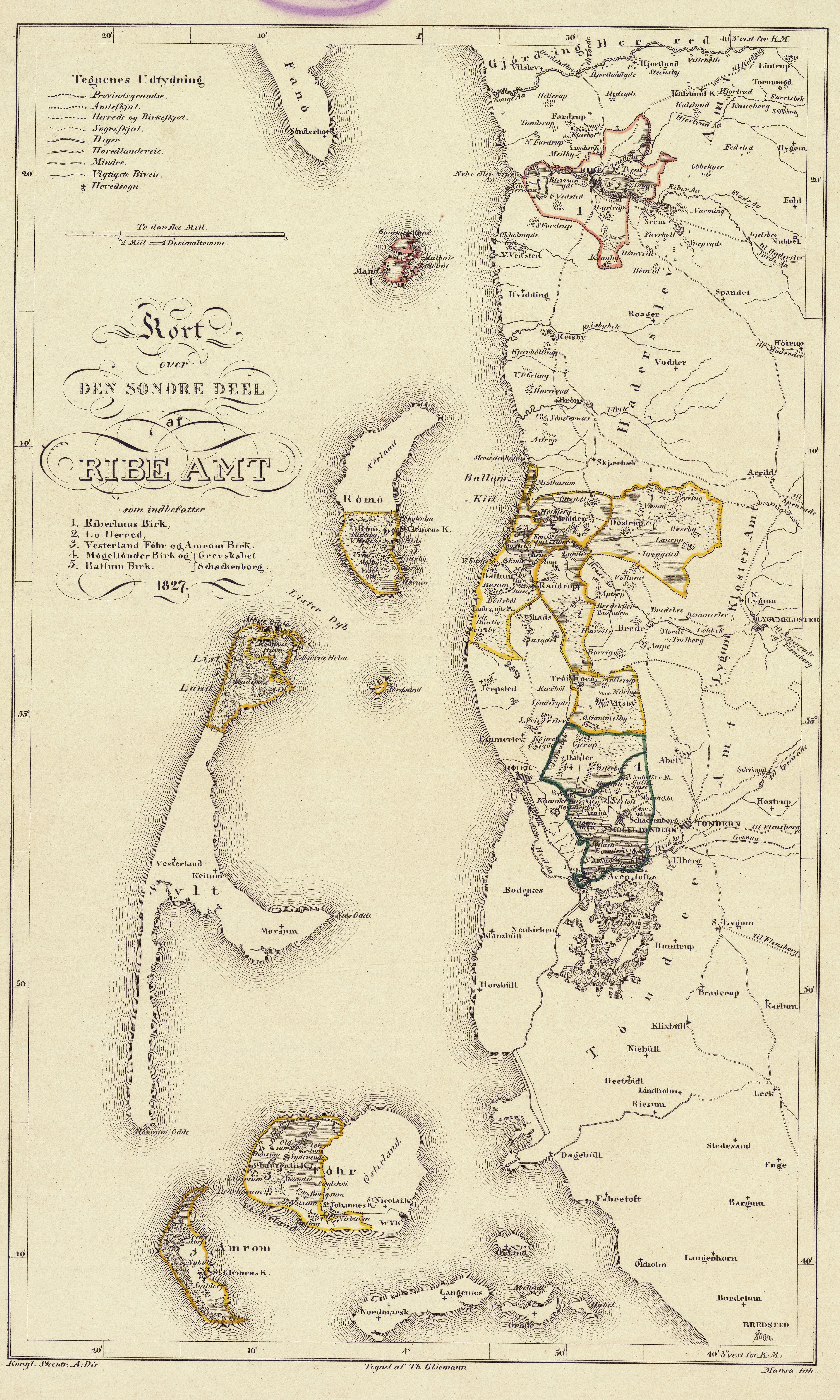
- ↑ The division of the island is shown on the Kort over den Søndre Deel af Ribe Amt from 1827 ( rostra.dk ).
- ↑ Rømø Motor Festival 2016 with many pictures on Zwischengas.com (last accessed September 27, 2016)

Islands in Denmark and Germany:
Amrum |
Fanø |
Foehr |
Koresand |
Langli |
Mandø |
Norderoogsand |
Pellworm |
Rømø |
Sylt |
Uthorn
Halligen:
Gröde |
Habel |
Hamburger Hallig |
Hooge |
Langeneß |
Norderoog |
Nordstrandischmoor |
Oland |
Süderoog |
South fall
High sands:
Japsand |
Jordsand |
Boy name sand |
Kniepsand |
Cormorant Island |
Süderoogsand