
Koresand
| Koresand | ||
|---|---|---|
 |
||
| Waters | North Sea | |
| Geographical location | 55 ° 14 '39 " N , 8 ° 29' 8" E | |
|
||
 |
||

The Koresand is a high sand in the southern Danish Wadden Sea southwest of the island of Mandø . There was at least one terp on Koresand until the island was abandoned in the 19th century after several storm surges . At around 20 square kilometers, Koresand is currently the largest sandbank in the Wadden Sea.
In the summer months there are guided mudflat walks and horse-drawn carriage trips from Mandø to Koresand. When the water level allows, a car drives to the west coast of Koresand every day, where the Wadden Sea ends and the open sea begins. With a suitable wind, a lot of amber can be found on Koresand . Seals can often be seen lying on the sand on the southwest side . The journey takes about two hours.
gallery
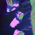
The Koresand southwest of Mandø, between Rømø in the south and Fanø in the north and the Jutland coast in the east (NASA Geocover 2000)

Koresand a little above the center of the picture, to the right behind Mandø, in the foreground Rømø, in the background Fanø


Islands in Denmark and Germany:
Amrum |
Fanø |
Foehr |
Koresand |
Langli |
Mandø |
Norderoogsand |
Pellworm |
Rømø |
Sylt |
Uthorn
Halligen:
Gröde |
Habel |
Hamburger Hallig |
Hooge |
Langeneß |
Norderoog |
Nordstrandischmoor |
Oland |
Süderoog |
South fall
High sands:
Japsand |
Jordsand |
Boy name sand |
Kniepsand |
Cormorant Island |
Süderoogsand