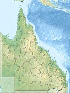
Mount Bellenden Ker
| Mount Bellenden Ker | ||
|---|---|---|
|
Josephine Falls of the Russell River |
||
| height | 1593 m | |
| location | Queensland , Australia | |
| Mountains | Barking Ker Range | |
| Coordinates | 17 ° 15 '51 " S , 145 ° 51' 14" E | |
|
|
||
| rock | granite | |
| First ascent | Robert Arthur Johnstone, 1873 | |
The Mount Bellenden Ker is with a height of 1593 m the second highest mountain in Queensland , Australia . It is named after the botanist John Bellenden Ker Gawler . The mountain is located 60 km south of Cairns near Babinda . It is located in the vicinity of Mount Bartle Frere , the highest mountain in Queensland, which is also part of the Bellenden Ker Range , also known as the Wooroonooran Range. The two mountains dominate the Josephine Falls area in the Wooroonooran National Park . Both mountains are made of resilient granite and are relics of a rock wall that was eroded by the influence of the Russell and Mulgrave Rivers .
Access
There are several television towers on Mount Bellenden Kerr. The only access to the television towers and to the summit is through a privately owned cable car.
history
In 1873, Walter Hill , the first botanist employed by the Queensland colonial government, went on an expedition to northern Queensland to collect plants and make a detour to Mount Bellenden Ker. That same year, Robert Arthur Johnstone climbed the summit when he was exploring the coastal landscape south of Cooktown with George Dalrymple . Archibald Meston (1851–1924) carried out another summit expedition in the spring of 1889.
environment
Precipitation
Measurements on the top of the mountain show an average annual precipitation of 8312 mm, which makes the local meteorological station the rainiest in Australia. It measured the highest precipitation record in the calendar year 2000 with 12,461 mm and the highest Australian value for a calendar month with 5387 mm in January 1979.
2006 fell with an annual rainfall of 9800 mm more precipitation than in all other regions of Australia. This mainly resulted from two massive tropical cyclones moving close to the mountain. In 2010, the richest year of rainfall since the introduction of rain measurements in Queensland, the Meteorological Station, which is located on the mountain top, reported annual rainfall of 12,438 mm - just below the 2000 measurement.
Bird life
Mount Bellenden Ker is located in the Wooroonooran Important Bird Area , which has been declared worthy of protection by BirdLife International because it is where endemic bird populations of the Queensland's Wet Tropics are located.
Individual evidence
- ^ Peter Shilton: Natural areas of Queensland . Goldpress, Mount Gravatt, Queensland 2005, ISBN 0-9758275-0-2 , p. 74 (Retrieved June 26, 2011).
- ^ Sarah Elks: On top of world, never rains but it pours . In: The Australia , News Limited, April 30, 2011. Retrieved June 26, 2011.
- ^ Dorothy Jones: Johnstone, Robert Arthur (1843-1905) . In: Australian Dictionary of Biography Online Edition . Melbourne University Press. Retrieved June 26, 2011.
- ↑ Media release: Queensland site sets Australian rainfall record . Bureau of Meteorology. 2001. Retrieved April 24, 2006.
- ↑ 2006 a year of 'extremes' for Qld weather . In: ABC News Online . Australian Broadcasting Corporation . January 4, 2007. Accessed on July 20, 2009. ( Page no longer available , search in web archives ) Info: The link was automatically marked as defective. Please check the link according to the instructions and then remove this notice.
- ^ Queensland in 2010 . In: Annual Climate Summary for Queensland . Bureau of Meteorology. January 4, 2011. Retrieved June 26, 2011.
- ^ BirdLife International. (2011). Important Bird Areas factsheet: Wooroonooran. Downloaded from http://www.birdlife.org on December 2, 2011.

