Mount Boennighausen
| Mount Boennighausen | ||
|---|---|---|
|
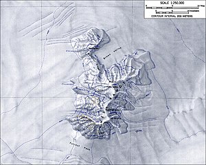
Topographic map of the Ames Range with Mount Boennighausen (scale 1: 250,000) |
||
| height | 2971 m | |
| location | Marie Byrd Land | |
| Mountains | Ames Range | |
| Coordinates | 75 ° 47 ′ 0 ″ S , 132 ° 18 ′ 0 ″ W | |
|
|
||
| Normal way | Alpine tour (glaciated) | |
Mount Boennighausen is a snow-capped and 2971 m high mountain in the West Antarctic Marie-Byrd-Land . In the Ames Range it rises 6 km south-southwest of Mount Kosciusko .
The United States Geological Survey mapped it based on its own surveys and aerial photographs of the United States Navy from 1959 to 1965. The Advisory Committee on Antarctic Names named it in 1974 after Lieutenant Commander Thomas L. Boennighausen of the Civil Engineer Corps of the US Navy, responsible for the nuclear power plant at McMurdo Station in 1966 and a member of the command staff of the US Navy Support Units in Antarctica from 1969 to 1970 and from 1970 to 1971.
Web links
- Mount Boennighausen in the Geographic Names Information System of the United States Geological Survey (English)
- Mount Boennighausen on geographic.org (English)

