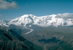
Mount Jarvis
| Mount Jarvis | ||
|---|---|---|
|
Mount Jarvis from the northeast |
||
| height | 4091 m | |
| location | Alaska ( USA ) | |
| Mountains | Wrangell Mountains | |
| Dominance | 16.18 km → Mount Wrangell (Peak 13,800) | |
| Notch height | 1439 m ↓ (2652 m) | |
| Coordinates | 62 ° 1 '24 " N , 143 ° 36' 59" W | |
| Topo map | USGS Nabesna A-6 | |
|
|
||
| Last eruption | 1-2 million years ago | |
The Mount Jarvis is a 4091 m high stratovolcano in the Wrangell Mountains in Alaska , about 90 km from the border to Canadian territory Yukon removed.
The mountain is located 13 miles east of Mount Wrangell and 72 miles northwest of McCarthy in Wrangell St. Elias National Park . Its shape resembles a dumbbell when viewed from above. The main summit and the 3970 m high north summit ( ⊙ ), about 5 km away, are connected by a 3749 m high saddle . Both summit regions are glaciated . The Nabesna Glacier extends to the south and the Copper Glacier to the northwest . The eastern flank of Mount Jarvis is drained through the Jacksina Glacier and Jacksina Creek to the Nabesna River .
The mountain was named in 1903 by FC Schrader of the United States Geological Survey after DM Jarvis of the United States Revenue Cutter Service , who spent several years in Alaska.

