Mount Keinath
| Mount Keinath | ||
|---|---|---|
|
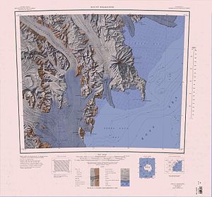
Topographic map of the Deep Freeze Range (center) with Mount Keinath |
||
| height | 1090 m | |
| location | Victoria Land , East Antarctica | |
| Mountains | Deep Freeze Range , Transantarctic Mountains | |
| Coordinates | 74 ° 32 ′ 0 ″ S , 163 ° 57 ′ 0 ″ E | |
|
|
||
| Normal way | Alpine tour (glaciated) | |
Mount Keinath is a 1090 m high mountain on the Scott coast of East Antarctica Victoria Land . In the Deep Freeze Range it rises on the eastern flank of the mouth of the Boomerang Glacier immediately west of the confluence of the Bates Glacier in the Browning Pass .
The United States Geological Survey mapped it based on its own surveys and aerial photographs of the United States Navy from 1955 to 1963. The Advisory Committee on Antarctic Names named it in 1968 after Gerald E. Keinath (1924-2003), administrator of the biological laboratory on the McMurdo Station from 1965 to 1966.
Web links
- Mount Keinath in the Geographic Names Information System of the United States Geological Survey (English)
- Mount Keinath on geographic.org (English)

