Naucalpan de Juarez
| Naucalpan de Juarez | ||
|---|---|---|
|
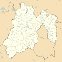
Coordinates: 19 ° 29 ′ N , 99 ° 14 ′ W Naucalpan de Juarez on the map of Mexico
|
||
| Basic data | ||
| Country | Mexico | |
| State | México | |
| Municipio | Naucalpan de Juarez , Huixquilucan | |
| Residents | 913,681 (2010) | |
| City insignia | ||
| Detailed data | ||
| height | 2440 m | |
| Los Remedios Church, Naucalpan de Juárez | ||
Naucalpan de Juárez , formerly San Bartolome Naucalpan and San Bartolo Naucalpan or shortly Naucalpan , is the third largest city in the central Mexican state of México to Ecatepec de Morelos and Nezahualcoyotl .
Naucalpan de Juárez extends over the two municipalities of Naucalpan de Juárez and Huixquilucan . Of the more than 900,000 inhabitants of the city, about 790,000 live in the part of the municipality of the same name, which is considered the Cabecera (capital) of this municipality. The city also includes settlement projects such as Ciudad Satélite and Lomas Verdes .
history
In pre-Columbian times, the region was part of the Empire of the Tepanecs .
Naucalpan became an independent municipality on January 1, 1826.
Sports
The headquarters of the Mexican ice hockey association Federación Deportiva de México de Hockey sobre Hielo is located in Naucalpan. The ice hockey stadium La Pista Lomas Verdes is one of two venues of the Liga Mexicana Élite, founded in 2010 .
Since 1962, Naucalpan has also been home to the most successful Mexican football club before the First World War, with six championship titles , Reforma Athletic Club . The English national team made guest appearances on his club premises during the football world championships in 1970 and 1986 .
Twin cities
Naucalpan has been twinned with Des Moines ( USA ) since 1972 . Further city partnerships were established in 1994 with Calgary in Canada and in 1997 with Anyang in South Korea .
sons and daughters of the town
- Café Tacuba (founded in 1989), a musical group
- Soraya Jiménez Mendivil (1977–2013), Olympic weightlifting champion


