
Elephantine Nilometer (Khnum Temple)
The grounds for the Chnum associated TEMPLE nilometer of Elephantine lies on the eastern bank of the Nile to the eastern Elephantine -Nilinsel. The construction date is not clear. Based on the archaeological findings, the completion took place at the earliest in the Saïten period and at the latest under Nectanebo II. (359 to 341 BC). During the Greco-Roman period , Augustus had the Nilometer systems renewed.
Location and structure

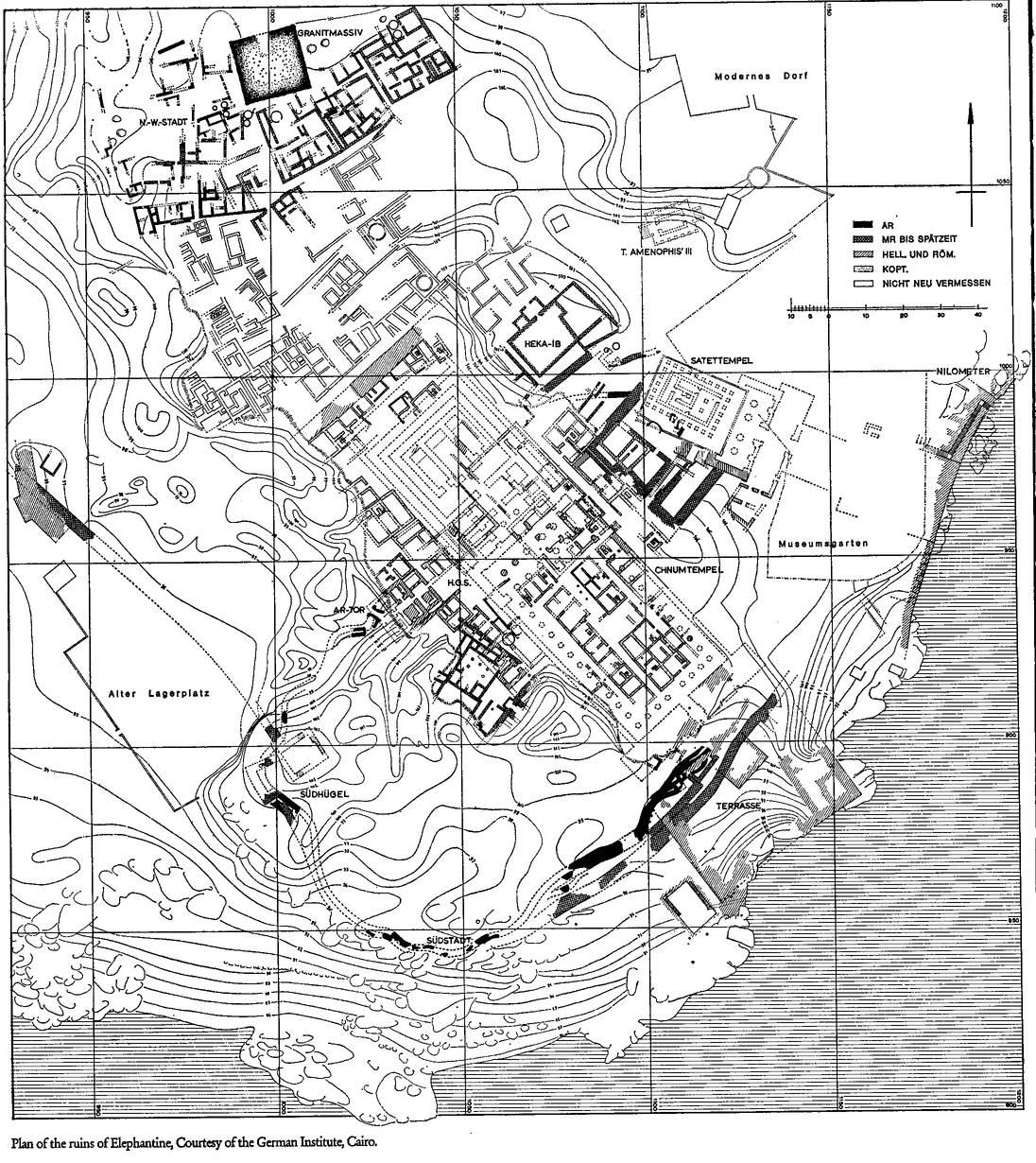
The Nilometer Basin is located south of the river terrace of the Khnum Temple, which in turn stood south of the Satis Temple. The Nilometer has a covered corridor that leads down to the banks of the Nile . The zero point of the original level scale corresponds to the height of the pelvic floor. Markings up to a height of 7 cubits have been preserved as a level scale . During his reign, Augustus arranged for the river terrace of the Khnum temple and the associated Nilometer to be redesigned.
Augustus at the latest had the scale system inserted into the east and north walls of the Nilometer basin that was already in place in the Nilometer system of the Satis Temple . The first measurement range started at about 15.35 cubits. The upper rim of the nilometer was a little over 27 cubits. The measuring range thus also corresponded to that of the Satis Temple Nilometer.
Nile flood heights
The lowest water levels in the Nile fell in the 19th century AD with 11 to 15 cubits in the period from April to the end of May / beginning of June . The existing Nile heights in Elephantine were in the range of 83.5 to 85.5 meters above sea level and thus about 2 meters above the level of the Greco-Roman period of 6 to 11 cubits. From a demotic building inscription , which probably comes from the new building phase, details about the measured values emerge: " Water (level) above the sandy bottom of the lake (basin): over 15 cubits, under 22 cubits, middle 19 cubits ." The interval information " middle 19 cubits ”, seems imprecise at first glance, as the mean value between the 15th and 22nd cubit is 18.5 cubits. The purpose of the center marking does not refer to the measuring range itself, but to the length of time that the Nile needs during the Nile flood to get to the 19th cubit. It takes about 28 days for the ascent from the 15th to the 22nd cubit; from the 15th to the 19th cubit about 14 days. On this basis, the mean figure is correct, as reaching the 19 cubits mark represented roughly the middle of the rising Nile flood in the specified measuring range. In addition, a reference to the Nilometer basin can be seen with regard to the measuring area, the basic dimensions of which were 15 x 22 cubits and which were probably already used in these delimitations in the first installation.
The Nile in Elephantine takes about 28 days until the end of August to rise from the 22nd cubit to the high tide peak during the flood of the Nile. Overall, the Nile needs about 56 days for the ascent from the 15th cubit to the apex of the Nile flood in relation to the Nilometer of the Khnum Temple. The Nile remains near its peak for about 6 to 10 days before it begins to plummet again. The total period until the fall of the Nile flood corresponds to 6 to 7 decades in the ancient Egyptian calendar. Another 2 to 3 decades were assigned to the decline. The measurements of the nilometer therefore covered an average of 9 decades (90 days) and thus about 3 lunar months . The middle lunar flood month of the Nile was considered to be a critical time , as at the end of the month the Nile usually exceeded the mark of 22 cubits. The upper edge of the Nilometer basin from the Temple of Khnum , like the monumental staircase by Elephantine, symbolizes this point in time as the “successful arrival of the Nile flood” and thus the beginning of the Nile festival Semasia , which has been documented since Greco-Roman times. The Nile flood inscriptions in the temple of Akoris show that the priests accompanied the ascent of the Nile up to the 22 cubit mark with ritual incantations. For the epoch from 284 to 305 AD, reaching that height of the Nile between August 3rd and 16th is documented; about 9 days later than in the Nilometer basin of the Khnum temple.
See also
literature
- Stephan Seidlmayer : Historic and modern Nile stands. Investigations into the level readings of the Nile from the early days to the present. Achet, Berlin 2001, ISBN 3-9803-7308-8 .
Web links
- Map of the Nilometer from the Khnum Temple On: aegyptologie.com ; last accessed on June 17, 2017.
Individual evidence
- ↑ a b c Stephan Seidlmayer: Historical and modern Nile stands. ... Berlin 2001, pp. 55–57 and pp. 59–60.
Coordinates: 24 ° 5 ′ 1 ″ N , 32 ° 53 ′ 12 ″ E