
Nonnenberg (Engelthaler Forest)
| Nonnenberg | ||
|---|---|---|
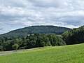
 The Nonnenberg, seen from the north |
||
| height | 579 m above sea level NHN | |
| location | Bavaria , Germany | |
| Mountains | Franconian Alb | |
| Coordinates | 49 ° 27 '46 " N , 11 ° 21' 43" E | |
|
||
| rock | White Jura | |

The Nonnenberg is a mountain in the Franconian Alb and is located in the district of Nürnberger Land .
geography
The mountain is located between Gersberg and Engelthal in the north, and Gersdorf and Entenberg in the south. The highest point of its summit plateau is at an altitude of 579 m above sea level. NHN . This plateau belongs to the community-free area Engelthaler Forst , as well as a large part of its northeast slope. To the east-southeast of the Nonnenberg lies the Buchenberg , via which the mountain is connected to the high plateau of the Franconian Alb. Several hiking trails run over the Nonnenberg, but it is completely uninhabited. The only civilization structures on its territory are a few hunting lodges.
history
In the Middle Ages there was a place of the same name on the southern slope of the Nonnenberg, which was inhabited before 1297. But as early as 1312, written records show that this place had become a desert.
The barren castle
In the Middle Ages there was a castle on a northern promontory of the Nonnenberg, but no contemporary documents are available. The place called Geierstein , where their remains are, is now called Burgstall Ödes Castle .
literature
- Ronald Hotler: Around the Moritzberg . Natural History Society Nuremberg eV, Fürth 1989, ISSN 0077-6149
photos

The Nonnenberg, as seen from the northwest
The Nonnenberg, looking west

The inner ditch of the desolate castle

.jpg)

Web links
- The Nonnenberg in BayernViewer (accessed on November 9, 2017)
- The Nonnenberg on a historical map (accessed on Nov. 9, 2017)
Individual evidence
- ↑ Geographical location of the Nonnenberg (accessed on November 9, 2017)
- ↑ Ronald Heissler: Around the Moritzberg . Page 100