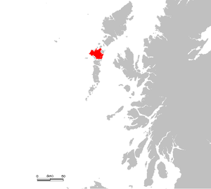
North Uist
| North Uist Uibhist a Tuath |
|
|---|---|
| Bay on North Uist | |
| Waters | North Atlantic |
| Archipelago | Outer Hebrides |
| Geographical location | 57 ° 36 ′ N , 7 ° 20 ′ W |
| surface | 303.05 km² |
| Highest elevation | 347 m above sea level NN |
| Residents | 1254 (2011) 4.1 inhabitants / km² |
| main place | Lochmaddy |
| Landsat photo by North Uist | |
North Uist ( Scottish Gaelic : Uibhist a Tuath ) is an island in the Outer Hebrides . In 2011, 1254 people lived on it. It is connected to the neighboring island of Benbecula (via Grimsay ) as well as to Berneray and Baleshare by means of dams . With the exception of the southeast, the island is very flat and over half is below sea level at high tide . The doctor and engineer Alasdair Ban MacLeod ("Dr. Ban", 1788-1854), who is native to North Uist , was one of the first administrators who systematically and professionally took care of the island's water management, agriculture and infrastructure.
The most important settlement on the island is the fishing port of Lochmaddy in the north , which is also the seat of a museum , an art center and a camera obscura . Ferries run from the village to Uig on Skye and from Otternish to Leverburgh in the southern region ( Harris ) of the Isle of Lewis and Harris . Other locations on North Uist include Port nan Long and Scolpaig, where the 19th century Scolpaig Tower is being rebuilt. Clachan na Luib is located southwest of Lochmaddy at the junction of the A865 and A867 national roads . The island of Benbecula has an airfield, the Benbecula Airport .
The island is known for its bird life , including the corncrake , arctic tern , gannet , bunting and puffin .
Attractions
North Uist has prehistoric remains, including a particularly large stone settings , such as the stone circle Pobull Fhinn and menhirs (standing stones) of Na Fir Bhreige, and also the Cairns of Barpa Langass and Unival that Broch Dun an Sticir and Dun Torcuill , the basement Druim na H-Uamha , some wheelhouses and the medieval “Teampull na Trionaid” (Trinity Temple).
Scolpaig Tower
The 19th century Scolpaig Tower (also known as MacLeod's Folly) is a romantic building on a small island in Loch Scolpaig . It was commissioned around 1830 by Alasdair (Alexander) "Ban" MacLeod in the neo-Gothic style as a job creation program against a famine. The tower stands on the site of an Iron Age brochure , nothing of which has survived. It has an octagonal floor plan, two floors and a crenellated crown.
It now serves as a bird nesting area and is maintained by the Council for Scottish Archeology.
Web links
Individual evidence
- ↑ 2011 census data
- ↑ [1]
- ↑ Entry on Dun Scolpaig in Canmore, the database of Historic Environment Scotland (English)


