South Uist
| South Uist Uibhist a Deas |
|
|---|---|
| Beinn Mhòr on South Uist | |
| Waters | North Atlantic |
| Archipelago | Outer Hebrides |
| Geographical location | 57 ° 16 ′ N , 7 ° 20 ′ W |
| length | 32 km |
| width | 10 km |
| surface | 320.26 km² |
| Highest elevation | Beinn Mhòr 620 m above sea level NN |
| Residents | 1754 (2011) 5.5 inhabitants / km² |
| main place | Lochboisdale |
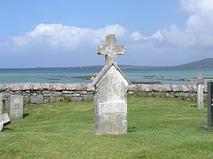
| Cemetery on South Uist | |
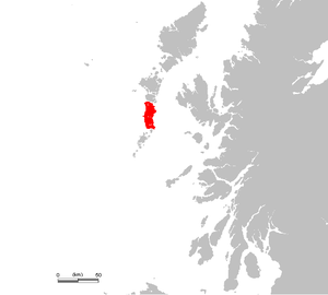
South Uist ( Scottish Gaelic : Uibhist a Deas ) is the second largest island in the Outer Hebrides in Scotland . It is 32 km long and 10 km wide. The capital and one of the most important ferry ports in the Outer Hebrides is Lochboisdale (Scottish Gaelic: Loch Baghasdail ). The majority of the population is Catholic. In addition to English, many residents speak Gaelic. In 2011, 1,754 people lived on South Uist.
North Uist is the island of North Uist . A test facility and launch sites for sounding rockets and military missiles have been located in the northwest of the island of South Uist since the 1950s . British Skua and Petrel missiles were deployed from here .
There are a number of prehistoric monuments on the north and south island group, including Dun Vulan , Kilpheder and South Clettraval .
Attractions
Kildonan Museum
The Kildonan Museum exhibits local finds from the millstone from 4000 BC to agricultural and nautical implements of the past to tool collections of various ancient crafts. The centerpiece of the Clach Chlann'ic Ailein ( Clanranald Stone ) collection, a stone from the 16th or 17th century from the wall of a chapel. It was stolen in 1990 and returned by the thief's heirs in 1995.
Howmore or Tobha Mòr (Gaelic)
It is a very important church center from the 9th to 13th centuries. It consists of a whole series of buildings, some of which have not yet been excavated. The place itself does not look very spectacular to the uninformed visitor. Currently only ruins are visible that have not been opened up for tourism. Only a single one explains where you are. The buildings are scattered within a few hundred meters.
Ormacleit Castle
Ormacleit Castle only survived in the form of remains of a wall, in which and around which a private individual runs a farm. The castle is the youngest on South Uist. It was built between 1701 and 1708 and burned down due to a kitchen fire as early as 1715. It belonged to the Ranald clan and was never rebuilt.
Caisteal Bheagram (Gaelic name)
It is located south of the town of Drimsdale (Gaelic: Dreumasdal) in Loch Eilean. It is not a castle, but a ruined tower on a tiny island in the loch , a freshwater lake.
Polochar Stone
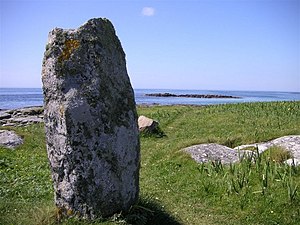
The Polochar Stone stands a few steps in front of the Polochar Inn at a viewpoint over the sea and the island of Barra. The stone is about 1.7 meters high and possibly dates from around 2000 BC. Or according to other information from the late Stone Age or early Bronze Age . The name 'Polochar' comes from the Gaelic of 'Poll a' Charra '(' stone by the bay / by the sea inlet ', where' Charra 'means stone,' Poll 'the water formation). See also Beinn a 'Charra .
Dun Altabrug
A tower similar to Caisteal Bheagram can be found north of Stoneybridge on a tiny island in Loch Altabrug. Numerous remains of the wall tell of a long-abandoned village near by in the country.
literature
- Frederick G. Rea: A School in South Uist (Reminiscences of a Hebridean Schoolmaster, 1890-1913) . ISBN 1-874744-87-4
Web links
- South Uist in the Encyclopedia Astronautica (English)
- The Big Garden, An Gàrradh Mòr - Historic winter garden that can be found on the southern tip of the island
Individual evidence
- ^ Entry in the Gazetteer for Scotland
- ↑ 2011 census data
- ↑ Ormacleit Castle Feature Page on Undiscovered Scotland . Website undiscoveredscotland.co.uk. With illustrations. Retrieved February 28, 2015.


