Nowohryhoriwka (Arbusynka)
| Novohryhorivka | ||
| Новогригорівка | ||

|
|
|
| Basic data | ||
|---|---|---|
| Oblast : | Mykolaiv Oblast | |
| Rajon : | Arbusynka district | |
| Height : | 190 m | |
| Area : | 0.95 km² | |
| Residents : | 382 (2001) | |
| Population density : | 402 inhabitants per km² | |
| Postcodes : | 55321 | |
| Area code : | +380 5132 | |
| Geographic location : | 48 ° 7 ' N , 31 ° 13' E | |
| KOATUU : | 4820382001 | |
| Administrative structure : | 1 village | |
| Address: | вул. Леніна буд. 10 55321 с. Новогригорівка |
|
| Website : | Website of the rural community Blahodatne | |
| Statistical information | ||
|
|
||
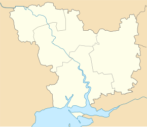
Novohryhoriwka ( Ukrainian Новогригорівка ; Russian Новогригоровка Novogrigorowka ) is a village in the north of the Ukrainian oblast with about 380 inhabitants (2001).
The village, founded in 1895, was an independent district council in the north of Arbusynka Rajon until December 2016 and has been part of the rural community of Blahodatne ( Благодатненська сільська громада ).
The village is located on the border with Kirovohrad Oblast at an altitude of 190 m , 20 km north of the community center Blahodatne ( Благодатне ), 31 km north of the Arbusynka district center and about 160 km northwest of the Mykolaiv oblast center .
South of the village which runs highway M 13 between Kropywnyzkyj and Okny on the border with Moldova .
Web links
Commons : Nowohryhoriwka - collection of pictures, videos and audio files
Individual evidence
- ↑ a b c local website on the official website of the Verkhovna Rada ; accessed on April 11, 2020 (Ukrainian)
- ↑ website of the municipal council on rada.info ; accessed on April 11, 2020 (Ukrainian)
- ^ Structure of the rural municipality Blahodatne on the official website of the municipality; accessed on April 11, 2020 (Ukrainian)


