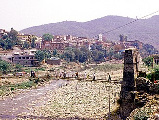
Nowshera Tawi
| Nowshera Tawi | ||
|
Jhula Bridge at Rajouri |
||
| Data | ||
| location | Jammu and Kashmir ( India ) | |
| River system | Indus | |
| Drain over | Munawwar Tawi → Chanab → Panjnad → Indus → Indian Ocean | |
| origin |
Pir Panjal 33 ° 32 ′ 10 ″ N , 74 ° 27 ′ 16 ″ E |
|
| Source height | approx. 3200 m | |
| Association with |
Neari Tawi to Munawwar Tawi Coordinates: 33 ° 5 ′ 31 " N , 74 ° 21 ′ 36" E 33 ° 5 ′ 31 " N , 74 ° 21 ′ 36" E
|
|
| length | approx. 100 km | |
| Catchment area | approx. 1200 km² | |
| Small towns | Rajouri | |
| Communities | Nowshera | |
The Nowshera Tawi (also Tawi ) is a tributary of the Chanab River in the Indian Union Territory of Jammu and Kashmir .
The Nowshera Tawi has its origin on the southwest slope of the Pir Panjal . It flows initially in a westerly direction, later in a southerly direction through the Rajouri district . He passes the district capital Rajouri . The so-called Punch Highway runs along the middle reaches of the Nowshera Tawi. The river flows through the hill country that is in front of the Pir Panjal. Shortly before the village of Nowshera , which is on the right bank of the river, it cuts through a smaller mountain ridge. The Punch Highway crosses the river 3.5 km above Nowshera .
The last 20 km below Nowshera, the Nowshera Tawi flows east. The river finally unites at Potha with the Neari Tawi coming from the east to form Munawwar Tawi , which flows further south and flows into the Chanab 20 km north of the city of Sialkot . The Nowshera Tawi has a length of approx. 100 km. It drains an area of 1200 km².
