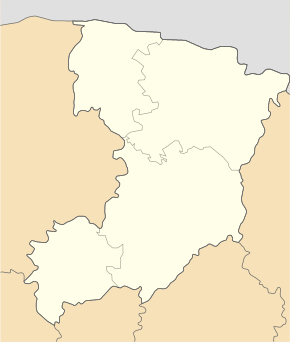
Obariw
| Obariw | ||
| Обарів | ||

|
|
|
| Basic data | ||
|---|---|---|
| Oblast : | Rivne Oblast | |
| Rajon : | Rivne district | |
| Height : | 186 m | |
| Area : | 1.83 km² | |
| Residents : | 2,927 (2001) | |
| Population density : | 1,599 inhabitants per km² | |
| Postcodes : | 35307 | |
| Area code : | +380 362 | |
| Geographic location : | 50 ° 39 ' N , 26 ° 10' E | |
| KOATUU : | 5624687401 | |
| Administrative structure : | 1 village | |
| Address: | вул. Шкільна буд. 50 35307 с. Обарів |
|
| Website : | City council website | |
| Statistical information | ||
|
|
||
Obariw ( Ukrainian Обарів ; Russian Обаров Obarow , Polish Obarów ) is a village in the Ukrainian Rivne Oblast with about 2900 inhabitants (2001).

Memorial to those who fell in the Great Patriotic War
The village, founded in the 15th century, belonged to the Kiev-Pechersk Lavra from 1515 to 1712 .
Obariw is the administrative center of the eponymous, 30.445 km² district council in Rivne Rajon , to which the village of Stawky ( Ставки , ⊙ ) with about 500 inhabitants belongs.
The village is a suburb of Rajon- and Oblastzentrum Rivne located 8 kilometers north-west of the inner city on the highway N 22 and the territorial road T-18-06 . Obariw has a train station on the Kovel – Kozyatyn railway line .
Web links
- Obarów . In: Filip Sulimierski, Władysław Walewski (eds.): Słownik geograficzny Królestwa Polskiego i innych krajów słowiańskich . tape 15 , part 2: Januszpol – Wola Justowska . Walewskiego, Warsaw 1902, p. 396 (Polish, edu.pl ).
Individual evidence
- ↑ Local website on the official website of the Verkhovna Rada ; accessed on October 6, 2017 (Ukrainian)
- ↑ history Obariw in the history of the towns and villages of the Ukrainian SSR ; accessed on October 6, 2017 (Ukrainian)
- ^ Website of the district council on the official website of the Verkhovna Rada; accessed on (ukrainian)

