Odiel
| Río Odiel | ||
|
Location of the Río Odiel in the west of Andalusia |
||
| Data | ||
| location | Huelva Province ( Spain ) | |
| River system | Río Odiel | |
| River basin district | Tinto-Odiel-Piedras | |
| source | in the Sierra de Aracena | |
| Source height | ~ 660 msnm | |
| muzzle | near Huelva in the Gulf of Cádiz Coordinates: 37 ° 16 '15 " N , 6 ° 57' 53" W 37 ° 16 '15 " N , 6 ° 57' 53" W |
|
| Mouth height | 0 msnm | |
| Height difference | 660 m | |
| Bottom slope | 4.4 ‰ | |
| length | 150 km | |
| Catchment area | 990 km² | |
|
Río Odiel |
||
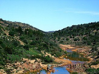
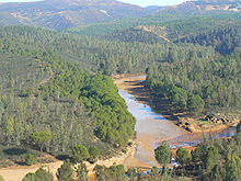
The Río Odiel is a river in southwestern Spain , in the autonomous region of Andalusia . It rises in the north of the province of Huelva in the Sierra de Aracena , which belongs to the Sierra Morena , and flows into the Ría de Huelva near the provincial capital Huelva , where it joins the Río Tinto . The Ría de Huelva is a ria on the Atlantic Ocean , into which the waters of the Odiel ultimately get.
In the source area of the Odiel there is a popular campsite. The river is also the namesake for a marshland nature park on its banks , the Parque Nacional Marismas del Odiel . The Odiel used to be navigable as far as Niebla , but its course has been changed.
proof
- ↑ Website with information about Spain ( page no longer available , search in web archives ) Info: The link was automatically marked as defective. Please check the link according to the instructions and then remove this notice. (PDF); Retrieved February 12, 2009.


