Ohio Key
| Ohio Key | ||
|---|---|---|
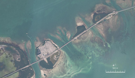
| Oblique aerial view looking towards the southeast | ||
| Waters | Gulf of Mexico | |
| Archipelago | Florida Keys | |
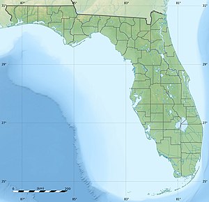
| Geographical location | 24 ° 40 ′ 19 ″ N , 81 ° 14 ′ 46 ″ W | |
|
|
||
| length | 775 m | |
| width | 665 m | |
| surface | 32.749 9 ha | |
| Residents | 19th (2000) 58 inhabitants / km² |
|
|
Ohio Key National Wildlife Refuge in the south of the island |
||
Ohio Key is an island in the Florida Keys in the US state of Florida . It has an approximately circular floor plan with a diameter of around 700 meters. It is located between Missouri Key in the east (separated by the Ohio Missouri Channel) and Bahia Honda Key in the west (separated by the Ohio Bahia Honda Channel) on kilometer 39 of the Overseas Highway section of US Highway 1 . The area is 32.75 acres , with a population of 19 at the 2000 census, all of whom live north of Highway 1. The island was once known as Little Duck Key and is now popularly known as Sunshine Key . Little Duck Key is now an island at the west end of the Seven Mile Bridge . The portion south of the US Highway 1 is the nature reserve Ohio Key National Wildlife Refuge .
Satellite image

Individual evidence
- ↑ Census 2000 , Monroe County, Census Tract 9714, Blocks 6036-6061


