Ōhope
| Ōhope | ||
| Geographical location | ||
|
|
||
| Coordinates | 37 ° 58 ′ S , 177 ° 3 ′ E | |
| Region ISO | NZ-BOP | |
| Country |
|
|
| region | Bay of Plenty | |
| District | Whakatāne District | |
| Ward | Whakatane-Ohope Ward | |
| Residents | 2 844 (2013) | |
| height | 3 m | |
| Post Code | 3121 | |
| Telephone code | +64 (0) 7 | |
| Photography of the place | ||
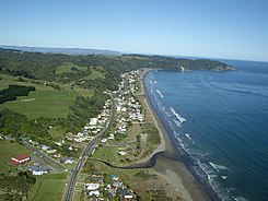
 Aerial view of Ōhope with the associated 12 km long beach |
||
Ōhope , often also called Ohope Beach , is a seaside resort in the Whakatāne District of the Bay of Plenty region on the North Island of New Zealand .
geography
Ōhope is just under 3 km east of Whakatāne and stretches for a good 9 km along the beach of Bay of Plenty , which is called Ohope Beach on this section . Part of the place lies on the eastward stretching headland that separates Ōhiwa Harbor from the Pacific Ocean .
Towards the eastern end of the village there is a jetty protruding into Ōhiwa Harbor . The part of the place is called Port Ōhope .
history
The coastal strip of Ōhope and the hinterland were settled early by the Māori tribe of the Ngāti Awa . From the late 18th century, the Ngāti Hokopu and the Ngāti Wharepāia , who could be assigned to the Ngāti Awa tribe , settled in the area on a large scale. Descendants of the tribes still live in Ōhope today .
The forest area, which extends from the coast about 4 km into the hinterland, was formerly the settlement area of the tribes and housed some Pā s (villages). Today the area is under protection as Ōhope Scenic Reserve , as the forest is home to the tree known by the Māori as Pōhutukawa and the northern strip kiwi .
population
In the 2013 census, the town had 2,844 inhabitants, 0.3% less than in the 2006 census.
Infrastructure
Road traffic
Ōhope has a direct connection to Whakatāne leading just under 5 km over the hills to the west and a connection to the New Zealand State Highway 30 and to the east a connection to the New Zealand State Highway 2 , which passes around 10 km to the southeast and has a 14.5 Kilometer long connecting road via the settlement of Wainui can be reached.
Shipping
The place has access to the Pacific Ocean via Port Ōhope with its jetty.
Education
The town has a primary school, called Ohope Beach Scholl , for grades 1-6 . In July 2014, the school had 293 students.
tourism
Ōhope lives from tourism, especially those looking for relaxation. As a seaside resort, Ōhope offers coastal walks , cycling, mountain biking, swimming, surfing and sailing. An 18-hole golf course is at the eastern end of the headland.
literature
- Helga Neubauer: Ohope . In: The New Zealand Book . 1st edition. NZ Visitor Publications , Nelson 2003, ISBN 1-877339-00-8 , pp. 344 .
Web links
Individual evidence
- ↑ a b 2013 Census QuickStats about a place : Ohope . Statistics New Zealand , accessed August 17, 2017 .
- ↑ a b c Topo250 maps . Land Information New Zealand , accessed August 17, 2017 .
- ↑ Ōhope Scenic Reserve . Department of Conservation , accessed August 17, 2017 .
- ^ Ohope Beach School . Education Review Office , September 12, 2014, accessed August 17, 2017 .
- ↑ Ohope Beach . Whakatāne District Council , September 12, 2014, accessed August 17, 2017 .

