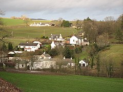
Old Bridge of Urr
| Old Bridge of Urr | ||
|---|---|---|
| View over Old Bridge of Urr | ||
| Coordinates | 54 ° 59 ′ N , 3 ° 55 ′ W | |
|
|
||
| administration | ||
| Post town | CASTLE DOUGLAS | |
| ZIP code section | DG7 | |
| prefix | 01556 | |
| Part of the country | Scotland | |
| Council area | Dumfries and Galloway | |
| British Parliament | Dumfries and Galloway | |
| Scottish Parliament | Galloway and West Dumfries | |
Old Bridge of Urr is a town in the Scottish Council Area Dumfries and Galloway . It is located about six kilometers north of Castle Douglas and 20 kilometers southwest of Dumfries on the left bank of the Urr Water , which joins the Solway Firth to the south . Historically, the Bridge of Urr was in the traditional county of Kirkcudbrightshire .
With the Old Bridge of Urr , the village received a two- arched arch bridge over the Urr Water in 1580 . Today, however, there is only one side street that ends in Castle Douglas. The B794 forms the main bridge of Urrs. It connects the village in the east to the A75 ( Gretna Green - Stranraer ) and in the north to the A712 ( Crocketford - Newton Stewart ).
The Old Bridge of Urr Mill is a monument of the highest Scottish monument category A in the village. The watermill is exceptionally well preserved. Nearby is the Urr moth .
Individual evidence
- ^ Entry in the Gazetteer for Scotland
- ↑ Urr, Bridge of in: FH Groome: Ordnance Gazetteer of Scotland: A Survey of Scottish Topography, Statistical, Biographical and Historical , Grange Publishing, Edinburgh, 1885.
- ↑ Listed Building - Entry . In: Historic Scotland .
- ↑ Listed Building - Entry . In: Historic Scotland .

