Ontake-san (Nagano)
| Ontake-san | ||
|---|---|---|
| height | 3067 m TP | |
| location | Nagano and Gifu Prefectures Japan | |
| Mountains | Ontakesan group | |
| Coordinates | 35 ° 53 '35 " N , 137 ° 28' 50" E | |
|
|
||
| Type | active stratovolcano | |
| Last eruption | September 27, 2014 | |
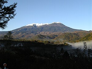
The Ontake ( Japanese 御 嶽山 , Ontake-san , literally: "honored summit", on- is an honorific prefix ) is a volcano massif and is located 100 km northeast of Nagoya on the border of the prefectures Nagano and Gifu . At 3,067 m it is the second highest volcano in Japan after Mount Fuji . In addition, the Ni-no-ike at the summit is Japan's highest mountain lake and the San-no-ike is the deepest among Japan's mountain lakes.
geography
location
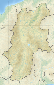
The Ontake lies on the territory of the prefectures Nagano and Gifu, with the boundary between the two prefectures running along the northwest rim of the main crater. The mountain belongs to the following communities clockwise: the east side to Kiso (Nagano), the south and south-west side to Ōtaki (Nagano), the north-west and north side to Gero (Gifu), and the northern foothills to Takayama (Gifu).
The Hida Mountains (Japanese Northern Alps), particularly the Norikura-dake , extend north of the Ontake massif , and the Kiso Mountains (Japanese Central Alps) to the east . However, the Ontake is also partially assigned to the Hida Mountains.
The eastern and southern parts of the massif with 19,046 hectares located in the area of Nagano was designated on March 3, 1952 as Ontake-san Nature Park ( 御 岳 県 立 公園 , Ondake-san kenritsu kōen ).
topography
![]() Map with all coordinates of the Topography section : OSM
Map with all coordinates of the Topography section : OSM
The mountain includes the following peaks:
| image | Surname | Height [m] | Coordinates |
|---|---|---|---|

|
Mamako-dake ( 継 子 岳 ) | 2859.1 | 35 ° 55 ' N , 137 ° 29' E |

|
Marishite yama ( 摩利 支 天山 ) | 2959.5 | 35 ° 54 ' N , 137 ° 29' E |

|
Kengamine ( 剣 ヶ 峰 ) | 3067 | 35 ° 54 ' N , 137 ° 29' E |

|
Mamahaha-dake ( 継 母 岳 ) | 2867 | 35 ° 54 ' N , 137 ° 28' E |
| Kamidawara-yama ( 上 俵 山 ) | 2277.1 | 35 ° 54 ' N , 137 ° 26' E | |
| Miura-yama ( 三浦 山 ) | 2393.7 | 35 ° 53 ' N , 137 ° 27' E | |

|
Mikasa-yama ( 三 笠 山 ) | 2256.3 | 35 ° 52 ' N , 137 ° 30' E |
| Komikasa-yama ( 小 三 笠 山 ) | 2029 | 35 ° 52 ' N , 137 ° 30' E |
The Kengamine on the southern edge of the crater as the highest point of the stratovolcano forms the border between Kiso, Ōtaki and Gero, the Mamako-dake that between Takayama and Kiso, the northern flank of the Mikasa-yama that between Kiso and Ōtaki, as well as the Mamahaha-dake and the Kamidawara -yama the border between Gero and Ōtaki.
In addition, there were originally five lakes or ponds with numerical names that literally mean "Lake 1" to "Lake 5", but today only two of them are constantly in water: the Ni-no-ike with a water depth of 3.5 m, is Japan's highest mountain lake, and San-no-ike is Japan's deepest mountain lake at 13 m. These five lakes are:
| image | Surname | Height [m] | Coordinates |
|---|---|---|---|

|
Ichi-no-ike ( 一 ノ 池 ) | 2988 | 35 ° 53 '42.7 " N , 137 ° 28' 43.9" E |

|
Ni-no-ike ( 二 ノ 池 ) | 2905 | 35 ° 53 '51.1 " N , 137 ° 28' 52.8" E |

|
San-no-ike ( 三 ノ 池 ) | 2720 | 35 ° 54 '27.1 " N , 137 ° 29' 12.4" E |

|
Yon-no-ike ( 四 ノ 池 ) | 2690 | 35 ° 54 '41.4 " N , 137 ° 29' 16.8" E |

|
Go-no-ike ( 五 ノ 池 ) | 2795 | 35 ° 54 '32.4 " N , 137 ° 29' 1.9" E |
Volcanism
The volcano lies to the north of a caldera four to five kilometers in diameter that was formed 70,000 to 90,000 years ago. A second caldera in the summit area with a diameter of around two kilometers may have formed during an eruption around 23,000 years ago.
The Ontake was held inactive until its eruption between October 28, 1979 and April 1980. This led to a phreatic explosion of level VEI 2, which released 200,000 tons of ash. Earlier, earthquakes were measured from May 1978, the strongest of which occurred on October 7, 1979 with a magnitude of 5.3. In September 1984, triggered earthquakes a landslide in the southern slope of the volcano, died by 29 people. Between May 13 and 16, 1991, as well as in January and March 2007, there were minor non-explosive (VEI0) phreatic eruptions.
On September 27, 2014, the volcano erupted again, killing 63 hikers, the first volcano casualties in Japan since the 1991 Unzen eruption . It was a water vapor explosion called a phreatic eruption . Apart from volcanic tremors and uplifts that started eleven minutes before the explosion, there was no advance warning. After the explosion, an ash cloud rose seven to ten kilometers high; up to 50 centimeters of ash fell near the crater. A three-kilometer pyroclastic current was moving down the southern slope of the volcano.
religion
The Ontake is the center of a number of religious ideas and practices of various Shugendō and Shintō groups (such as the Ontake-kyō ), which are collectively referred to as Ontake Shinkō ( 御 嶽 信仰 , "Ontake belief").
There are several Shinto shrines on the mountain , with the Ontake shrine ( 御 嶽 神社 , Ontake-jinja ) in particular, which consists of two main shrines - called Ōtakiguchi ( 王 滝 口 ) and Kurosawaguchi ( 黒 沢 口 ) - with the former main building at 2920 m and that of the second on the edge of the Kengamine crater at 3060 m, as well as various side shrines along the Ōtakiguchi path from the foot of the mountain to the summit.
Sports
The southeast slope of the Mikasa-yama mountain peak is designated as the Ontake 2240 ( お ん た け 2240 ) ski area with eight different routes. Two of them are also certified by the FIS as a joint 1900 m long Super-G course . From April 3 to 6, 2014, the first FIS race took place there with the 2nd Macearth / Westberg Ontake2240 Cup in the downhill and Super-G disciplines.
See also
Web links
- Ontake-san in the Global Volcanism Program of the Smithsonian Institution (English)
- Nakayama Hajime: "Ontake Shinko" . In: Encyclopedia of Shinto. Kokugaku-in , March 28, 2007 (English)
Individual evidence
- ↑ a b c 二 ノ 池 (2905m). (No longer available online.) Ōtaki Municipality, archived from the original on September 29, 2014 ; Retrieved September 29, 2014 (Japanese). Info: The archive link was inserted automatically and has not yet been checked. Please check the original and archive link according to the instructions and then remove this notice.
- ↑ a b c 三 ノ 池 (2720m). Ōtaki Ward, accessed September 29, 2014 (Japanese).
- ↑ a b 1: 25,000 火山 土地 条件 図 解説 書 (御 嶽山 地区) . (PDF) Kokudo Chiriin , March 2012, pp. 5–8 , accessed on September 1, 2016 (Japanese).
- ↑ 御 嶽山 . In: Daijisen at kotobank.jp. Retrieved September 29, 2014 (Japanese).
- ↑ 長野 県 の 自然 公園 の 紹 介 . 御 岳 県 立 公園 . Nagano Prefecture, accessed September 30, 2014 (Japanese).
- ↑ a b Height and coordinate information according to the official topographic map
- ^ Christopher G. Newhall, Daniel Dzurisin: Historical unrest at large calderas of the world . USGS Bulletin 1855, 1988 (English, PDF, 37 MB), p. 466.
- ↑ 御 嶽山 有 史 以降 の 火山 活動 . Japan Meteorological Agency , 2013, accessed September 29, 2014 (Japanese).
- ↑ Tom Fay: Mount Ontake: Four years after its deadly eruption. In: The Japan Times . September 8, 2018, accessed November 14, 2018 .
- ↑ a b Weekly Reports September 24 to September 30, 2014. In: Global Volcanism Programm. October 1, 2014, accessed October 3, 2014 .
- ↑ 30 people found lifeless near the volcano. In: sueddeutsche.de. September 28, 2014, accessed September 29, 2014 .
- ↑ 広 報 お う た き . (PDF; 1.1MB) Otaki Village, January 15, 2013, accessed September 1, 2016 (Japanese).
- ↑ Ontake in the database of the International Ski Federation (English), accessed on September 29, 2014


