Oquirrh Mountains
| Oquirrh Mountains | ||
|---|---|---|
|
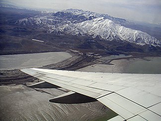
The Oquirrh Mountains from the northeast, below the Great Salt Lake |
||
| Highest peak | Flat Top Mountain ( 3237 m ) | |
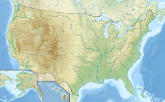
| location | Utah (USA) | |
|
|
||
| Coordinates | 40 ° 35 ′ N , 112 ° 11 ′ W | |
| Age of the rock | 300 Ma | |
The Oquirrh Mountains [ oʊkɚ ] is a mountain range in the US - state of Utah , where the Salt Lake Valley more than 50 km from the western Tooele Valley separates. The mountains end on the south bank of the Great Salt Lake . The highest point is the 3237 meter high Flat Top Mountain ( Lage ). The name Oquirrh means "wooded mountain" in the language of the Gosiute Indians.
Gold , silver , lead and especially copper were mined in the mountains . Seen from Salt Lake City , the material deposited in the open pit copper is particularly striking.
During the winter months, the mountains are populated by a small population of bald eagles .
geology
The Oquirrh Mountains formed around 300 million years ago with the Appalachians , at that time still as a contiguous mountain range. After the formation of the supercontinent Pangea was completed and he broke again that which forms North American continent emigrated before 95 million years over the Bermuda - Hotspot , this raised the area around present-day Mississippi lowlands within 10 million years ago to 2,000 meters to 3000 m high. Erosion carried away the bulge over the next 70 million years, and after the continent moved across the plume , the area subsided by the same amount as it was previously raised. The now flooded Mississippi lowlands separate the Oquirrh from the Appalachian Mountains.
literature
- Roy B. Van Arsdale et al. Randel T. Cox: The Strange History of the Mississippi . In: Spectrum of Science . 6/07., No. 6, 2007, ISSN 0170-2971 , pp. 68-75.
Web links
- History of the mountain (English)

