Pæregård
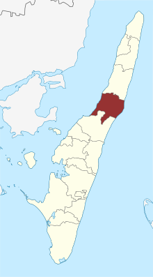
The dolmen and burial mounds of Pæregård are located on the eponymous farm southwest of Tranekær on the Danish island of Langeland . The dolmens date from the Neolithic Age around 3500–2800 BC. And are megalithic systems of the funnel beaker culture (TBK). Neolithic monuments are an expression of the culture and ideology of Neolithic societies. Their origin and function are considered to be the hallmarks of social development.
The dolmens
The long hill of the dolmen ( Danish Langdysse ) lies in a field on the western cliff. The megalithic bed of the three transverse rectangular pillars is about 36.0 × 8.0 m in size and oriented NNE-SSW. 45 curb stones, about half of the original number, have been preserved. All of them have their flat side facing outwards, and with a height of about one meter they are unusually large for Danish megalithic structures in long beds (compare passage grave from Myrebjerg ), especially since they are even larger at the hill ends. The three transverse chambers, all with a corridor to the east, are located in the southern part of the megalithic bed, are somewhat disturbed and have no cap stones.
- The south chamber, made of five bearing stones, measures around 2.0 × 1.0 m. There is a large threshold stone in the entrance . There is only one pair of bearing stones left of the corridor.
- The middle chamber is almost completely destroyed. The threshold stone and two support stones of the corridor have been preserved.
- The north chamber is slightly larger than 2.0 × 1.0 m and consists of 5 supporting stones - in between well-preserved dry masonry, a threshold stone in the access and a pair of supporting stones from the corridor.
In the chambers excavated in 1951, skeletal parts and shattered clay vessels as well as objects made of amber , flint and bones from the Neolithic period were found.
In the northern chamber there was also the skeleton of a young woman, probably from the time of the dagger . A layer of sherds was found in front of the passageway openings, which probably stems from the fact that clay vessels were placed on the curbs as offerings.
Nearby
About 900 m away, on the southern edge of the forest, there are three burial mounds on both sides of the road. Farthest to the west was a barren bed with dolmens which we only know that it was destroyed in the 19th century. You can only see an elevation at the edge of the forest with a single large curb. Further to the east is a ruined hill, the age and nature of which are uncertain. Right next to the forest path, there is a dilapidated dolmen in the round hill with a completely destroyed chamber. None of these three hills were examined.
Nearby are Ringelhøj in Snave Forest (a disturbed barn bed), the megalithic complexes at Ravnebjerg Skov and the barren beds at Frellesvig .
See also
literature
- Jens Bech: Monuments on Langeland (= Tryk from Langelands Museum. Vol. 4, ZDB -ID 2370563-2 ). 2nd edition. Langelands Centraltrykkeri, Rudkøbing 1981.
- H. Berg: Langdolmen near Pæregård, Langeland In: Acta Archaeologica 27 1956 pp. 108–127
- Ingrid Falktoft Anderson: Vejviser til Danmarks oldtid . 1994, ISBN 87-89531-10-8 , p. 227
Web links
Individual evidence
- ^ Johannes Müller : Neolithic Monuments and Neolithic Societies. In: Hans-Jürgen Beier , Erich Claßen, Thomas Doppler, Britta Ramminger (eds.): Varia neolithica VI. Neolithic Monuments and Neolithic Societies. Contributions from the meeting of the Neolithic Working Group during the annual meeting of the North-West German Association for Ancient Research in Schleswig, 9. – 10. October 2007 (= contributions to the prehistory and early history of Central Europe. Vol. 56). Beier & Beran, Langenweißbach 2009, ISBN 978-3-941171-28-2 , pp. 7-16, here p. 15.
- ↑ Langdysser is the common denomination in Denmark for dolmens that lie in a rectangular barren bed , in contrast to this, round dolmen or round dysser are those dolmens that are located in a round hill
Coordinates: 54 ° 58 ′ 53.4 ″ N , 10 ° 46 ′ 20.6 ″ E
