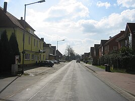
Pödinghausen
|
Pödinghausen
City of Enger
Coordinates: 52 ° 7 ′ 4 ″ N , 8 ° 32 ′ 37 ″ E
|
|
|---|---|
| Height : | 128 m above sea level NN |
| Area : | 3.27 km² |
| Residents : | 2236 (Dec. 31, 2007) |
| Population density : | 684 inhabitants / km² |
| Incorporation : | 1st January 1969 |
| Postal code : | 32130 |
| Area code : | 05224 |
|
Location of Pödinghausen in Enger
|
|
|
Pödinghausen center
|
|
Pödinghausen is a district in the south of Enger , North Rhine-Westphalia and has about 2200 inhabitants.
history
On January 1, 1969, the previously independent community of Pödinghausen was incorporated into Enger.
religion
In Pödinghausen there is a parish hall that belongs to the parish of Oldinghausen-Pödinghausen and is run by the Evangelical Church Community of Enger. A church and children's choir are also located there.
traffic
Pödinghausen is connected to public transport via line 54. Several designated cycle paths run through the village, including the “HF3” path and a cycle path that is marked with the Westphalian coat of arms as a symbol. The Weser / Lippe train-bike route and the Orange route to Herringhausen continue through the town.
Companies
At the end of the town there is an industrial area Enger Süd , the largest companies there are a kitchen manufacturer and a bus company that is mainly responsible for school traffic.
Sports
The place has a lawn area with floodlights and also has a smaller area with artificial turf. It is home to the soccer club “TuS Grün-Weiß Pödinghausen”. This club also operates other sports such as children's gymnastics, karate, women's gymnastics, handball or badminton, but these are in the sports hall of the primary school in Oldinghausen . Another sports club is the Ravensberger Land Golf Club.
Individual evidence
- ↑ Martin Bünermann: The communities of the first reorganization program in North Rhine-Westphalia . Deutscher Gemeindeverlag, Cologne 1970, p. 74 .


