Belke-Steinbeck
|
Belke-Steinbeck
City of Enger
Coordinates: 52 ° 9 ′ 27 ″ N , 8 ° 34 ′ 48 ″ E
|
|
|---|---|
| Height : | 95 m above sea level NN |
| Area : | 3.82 km² |
| Residents : | 2406 (Dec. 31, 2007) |
| Population density : | 630 inhabitants / km² |
| Incorporation : | 1st January 1969 |
| Postal code : | 32130 |
| Area code : | 05224 |
|
Location of Belke-Steinbeck in Enger
|
|
|
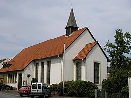
Ev.-luth. Lukas Church in Belke-Steinbeck
|
|
Belke-Steinbeck is about 2,500 inhabitants counting district of the northeastern North Rhine-Westphalia located east Westphalian town of Enger . Before the regional reform in 1969, it formed its own community .
history
From 1823 to 1958, there was a public bathing establishment on today's “Belker Brunnen” street, the so-called “Bad Belke”. Tub baths with medicinal properties were offered there.
The Herford small railway ran through Belke-Steinbeck from 1900 to 1966 ; From Steinbeck station you could take the narrow-gauge railway, which has been electrically operated since the 1930s, directly to the east. a. Drive to the district town of Herford , Bad Salzuflen and Vlotho . In a westerly direction you could drive to the Wallenbrück district of Spenger. In 1966 the Herford small railway was stopped.
On January 1, 1969, Belke-Steinbeck was incorporated into Enger.
education
In the Humboldtstr. 20 is the Belke-Steinbeck / Besenkamp community elementary school.
Individual evidence
- ↑ Martin Bünermann: The communities of the first reorganization program in North Rhine-Westphalia . Deutscher Gemeindeverlag, Cologne 1970, p. 74 .


