Panguipulli
| Panguipulli | ||
|---|---|---|
|
Coordinates: 39 ° 38 ′ S , 72 ° 20 ′ W Panguipulli on the map of Chile
|
||
| Basic data | ||
| Country | Chile | |
| region | Región de Los Ríos | |
| City foundation | 1946 | |
| Residents | 34,539 (2017) | |
| City insignia | ||
| Detailed data | ||
| surface | 3292 km 2 | |
| Population density | 10.49 inhabitants / km 2 | |
| height | 130 m | |
| Waters | Lake Panguipulli | |
| Time zone | UTC −4 | |
| Website | ||
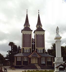
| Capuchin Church Panguipullis | ||
Panguipulli (in mapudungun: pangi pülli , 'spirit of the puma') is a Chilean city and municipality in the Región de Los Ríos . It is located in the northeast of the region and borders Argentina and the Región de la Araucanía .
history
The first inhabitants of Panguipulli were indigenous Mapuche communities. Their settlement areas were on the banks of the numerous lakes and rivers in the area. The first written records date from 1776. The first European settler Guillermo Angermeyer came to the region in 1885. In 1903 a mission station of the Capuchin Order was founded in Panguipulli. In 1946 Panguipulli became its own community. In 1947 a church and a boarding school were founded by Padre Bernabé from Lucerne. Today in the community of Panguipulli Mapuche, some of them live in communities, Chileans from other areas of Chile and some German colonists. In the second half of the 20th century, the area was mainly characterized by forestry and there was also a railway connection. Today tourism dominates as the main economic branch. 1954 the train connection from Lanco to Panguipulli was opened. In the meantime, remote areas such as Neltume and Puerto Fuy can also be reached via an asphalt road.
tourism
Panguipulli is located in the destination "Siete Lagos" (Lago Pellaifa, Lago Calafquén , Lago Pallinque, Lago Pirihueico , Lago Neltume, Lago Panguipulli , Lago Riñihue ). Tourism has increased significantly in recent years and the service has been professionalized. The Mocho-Choshuenco volcanic complex , the southern entrance of the Villarrica National Park and the Huilo Huilo Biological Reserve are located in the municipality.
geography
The municipality is characterized by an Andean mountain landscape with a treasure trove of glacial shapes (tongue basin lakes, moraines) and recent volcanism.
climate
The climate is humid and temperate all year round. The region is particularly rainy in the southern winter; the average temperatures vary between 7 ° C in July and 16 ° C in January.
| Panguipulli | ||||||||||||||||||||||||||||||||||||||||||||||||
|---|---|---|---|---|---|---|---|---|---|---|---|---|---|---|---|---|---|---|---|---|---|---|---|---|---|---|---|---|---|---|---|---|---|---|---|---|---|---|---|---|---|---|---|---|---|---|---|---|
| Climate diagram | ||||||||||||||||||||||||||||||||||||||||||||||||
| ||||||||||||||||||||||||||||||||||||||||||||||||
|
Average monthly temperatures and rainfall for Panguipulli
Source: [2]
|
|||||||||||||||||||||||||||||||||||||||||||||||||||||||||||||||||||||||||||
Individual evidence
- ↑ COMUNA. Retrieved April 14, 2019 (es-CL).
- ↑ CONSEJO NACIONAL DE LA CULTURA Y LAS ARTES: CARACTERIZACIÓN DEL PATRIMONIO FERROVIARIO DE LA REGIÓN DE LOS RÍOS. In: CONSEJO NACIONAL DE LA CULTURA Y LAS ARTES. CONSEJO NACIONAL DE LA CULTURA Y LAS ARTES, November 13, 2015, accessed on April 14, 2019 (Spanish).


