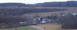
Panzweiler (Gemünden)
|
Panzweiler
Local community Gemünden
Coordinates: 49 ° 54 ′ 28 " N , 7 ° 28 ′ 35" E
|
||
|---|---|---|
| Height : | 292 m above sea level NN | |
| Incorporation : | April 1, 1939 | |
| Postal code : | 55490 | |
| Area code : | 06765 | |
|
Location of Panzweiler in Rhineland-Palatinate |
||
|
Panzweiler
|
||
Panzweiler is a district of the municipality of Gemünden in the low mountain range of the Hunsrück in the Rhein-Hunsrück district in Rhineland-Palatinate and is part of the Soonwald-Nahe nature park .
Geography and history
The village of Panzweiler is located in the Simmerbach valley between the main town of Gemünden and the Womrath district of Wallenbrück . A forest path leads along the Scheidbach to Dickenschied . The Panzweiler children went to school in Womrath until June 7, 1931; one sixth of this was paid for by Panzweiler. Until the beginning of the 20th century, the residents of the village belonged to the Evangelical parish of Dickenschied.
Individual evidence
- ^ Hotte Schneider: Womrath - A village in the Hunsrück ; Womrath: Ortsgemeinde Womrath, 1999; ISBN 3-00-004779-4 ; P. 216
- ^ Hotte Schneider: Womrath - A village in the Hunsrück ; Womrath: Ortsgemeinde Womrath, 1999; ISBN 3-00-004779-4 ; P. 135

