Pao Pao
| Pao Pao | ||
|---|---|---|
|
|
||
| Coordinates | 17 ° 31 ′ S , 149 ° 49 ′ W | |
| Basic data | ||
| Country | France | |
| Overseas local authority | French Polynesia | |
| ISO 3166-2 | FR-PF | |
| height | 39 m | |
| Residents | 4244 (2007) | |
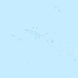
Pao Pao is a city on the island of Moorea in the Pacific Ocean . It belongs to French Polynesia . In 2007 the city had 4,244 inhabitants , making it the largest city on the island .
geography
Pao Pao is located on Cook's Bay on the Pacific island of Moorea . The city is surrounded by mountains. The next big island is Tahiti to the east .
history
Pao Pao was first settled by Asians . They built houses out of branches and twigs and lived off fishing . One day James Cook discovered the island and a bay was named after him.
traffic
Most of the city's residents use the nearby Moorea airfield to fly to other islands. There is also a ferry connection to the neighboring island of Tahiti . The journey time is 45 minutes. These connections keep tourists coming to the city.
Individual evidence
- ↑ Google Maps GPS coordinates, latitude and longitude. Retrieved September 1, 2017 .
- ↑ FRANK RILEY: Moorea Island Is Drawing Its Own Fans . In: Los Angeles Times . January 3, 1988, ISSN 0458-3035 ( latimes.com [accessed September 1, 2017]).
- ↑ Trlib.info. (No longer available online.) Archived from the original on September 2, 2017 ; accessed on September 1, 2017 . Info: The archive link was inserted automatically and has not yet been checked. Please check the original and archive link according to the instructions and then remove this notice.

