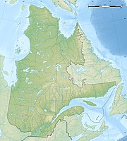
Parc national du Lac-Témiscouata
|
Parc national du Lac-Témiscouata
|
||
|
Île Notre-Dame |
||
| location | Quebec , Canada | |
| surface | 176.5 km² | |
| WDPA ID | 67320 | |
| Geographical location | 47 ° 44 ' N , 68 ° 48' W | |
|
|
||
| Setup date | 2009 | |
| administration | Parcs Québec, SEPAQ | |
The Parc national du Lac-Témiscouata is one of the currently 27 national parks in the Canadian province of Québec . There a parc national corresponds to what is called a provincial park in the other provinces . The park is operated by Sépaq ( French Société des établissements de plein air du Québec or English Society of outdoor recreation establishments of Quebec ).
The task of the 176.5 km² park, established in the south of the province in 2009, is to protect and represent the peculiarities of a small area of the Monts Notre-Dame (21,720 km²), an ecoregion that is still the only one in southern Québec had not been placed under protection in this way. The mountain range is part of the Appalachian Mountains . The park consists of two sub-areas, a 157.2 km² main part north-east of Lac Témiscouata and an area of 18.1 km² southeast of the lake. This has an area of 67 km² and is 45 km long.
fauna
At least 20 of the 40 mammal species of the mountain range live in the park, including elk , black bear and white-tailed deer , coyote (which has disappeared since 1971) and originally also the wolf , which has disappeared since the end of the 19th century, then red fox , ermine , mink , spruce - and fishing marten (also called pecan), as well as new world otters (also called otters), lynx , snowshoe hare , finally Tamiasciurus hudsonicus, a tree squirrel , Tamias striatus, a squirrel , Glaucomys volans from the genus of the New World flying squirrel , of which only two species exist. It is also called the southern flying squirrel to distinguish it from the northern one found in northern Canada and Alaska. There are also Urson or tree porcupines, beavers and muskrats .
history
About 50 archaeological sites are known around the lake. The oldest go back 10,000 years. The strategic location of the lake between the Atlantic Ocean and the St. Lawrence River played a decisive role from the start. The only site that can be assigned to the early Archaic period so far bears the abbreviation CjEd-8 according to the Borden system . In contrast to most of the simultaneous finds in Québec, quartz is hardly represented. At the same time, it can be seen that the long-distance contacts, for example with trade goods, were still rather low compared to the rest of the province.
The Témiscouata Lake was part of the traditional territory of the Maliseet , an Algonk group of the Abenakikon Federation, in prehistoric times . It is from them that the name of the lake comes from, which translates as 'deep lake'. A trade route ran here, the Témiscouata- Portage , a canoe and land route that led from Fundy Bay to the Saint Lawrence River .
With the introduction of the feudal order in New France (Coutume de Paris), the area was divided into seigneuries , huge mansions on which peasants lived who had to do taxes and labor. In 1683 Charles-Aubert de la Chenaye was appointed to the Madouesca (Témiscouata) rule.
The border between British North America and the United States ran further south . The border conflict almost led to the Aroostook War in 1838/39 , but it was settled in 1842 with the Webster-Ashburton Treaty . In addition to forts such as Grand Sault and Petit Sault ( Edmundston ) in New Brunswick and Fort Degele in Québec, the British secured their territory with the construction of Fort Ingall at the southern end of Lake Témiscouata. The fort was abandoned in 1842. From 1972 to 1978 excavations took place, which led to the fort being reconstructed and now used as a museum.
The actual settlement did not begin until 1850. A first large sawmill was built in 1865 and in 1889 a railway connection, the Témiscouata Railway , reached the lake area between Edmundston and Rivière-du-Loup .
See also
literature
- Julie Brunet: Le site CjEd-8: l'Archaïque supérieur au Témiscouata , thèse, Université de Montréal 2010.
Web links
- Parc national du Lac-Témiscouata , Sépaq (French)
- État des connaissances. Parc national du Lac-Témiscouata
- Commission de toponymie du Québec: Parc national du Lac-Témiscouata
Individual evidence
- ↑ État des connaissances: Parc national du Lac-Témiscouata Annexe V: Les mammifères susceptibles d'être observés dans le territoire à l'étude (PDF; 36 kB), Ministère du Développement durable, de l'Environnement et des Parcs.
- ↑ This and the following from: Julie Brunet: Le site CjEd-8: l'Archaïque supérieur au Témiscouata , thèse, Université de Montréal 2010.
- ↑ Fort Ingall ( Memento of the original from June 11, 2008 in the Internet Archive ) Info: The archive link was automatically inserted and not yet checked. Please check the original and archive link according to the instructions and then remove this notice.


