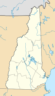
Pembroke, New Hampshire
| Pembroke | ||
|---|---|---|
|
Location in New Hampshire
|
||
| Basic data | ||
| Foundation : | 1759 | |
| State : | United States | |
| State : | New Hampshire | |
| County : | Merrimack County | |
| Coordinates : | 43 ° 9 ′ N , 71 ° 27 ′ W | |
| Time zone : | Eastern ( UTC − 5 / −4 ) | |
| Residents : | 6,897 (as of: 2000) | |
| Population density : | 302.5 inhabitants per km 2 | |
| Area : | 23.0 km 2 (approx. 9 mi 2 ) of which 22.8 km 2 (approx. 9 mi 2 ) is land |
|
| Height : | 126 m | |
| Postal code : | 03275 | |
| Area code : | +1 603 | |
| FIPS : | 33-60020 | |
| GNIS ID : | 0873696 | |
| Website : | www.pembroke-nh.com | |
Pembroke is a village in Merrimack County , New Hampshire in the United States .
history
The village was founded in 1728 and named "Lovewell's Town" after the officer "John Lovewell". A short time later the village was renamed Suncook, after the river of the same name. It was not until 1759 that the village was named Pembroke after the ninth Earl of Pembroke in Wales .
Pembroke had many watermills powered by the Suncook River. In 1852 a railway line including a station was built. This makes Pembroke the center of population of New Hampshire.
education
Pembroke has four schools. The "Village School" is for kindergarten children as well as first graders. The "Hill School" is from the second to the fourth grade, the "Three River School" to the eighth grade and the "Pembroke Academy" for the remaining grades.
Known residents
- Megan McTavish , an actress
