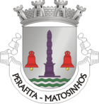
Perafita (Portugal)
| Perafita | ||||||
|---|---|---|---|---|---|---|
|
||||||
| Basic data | ||||||
| Region : | Norte | |||||
| Sub-region : | Porto metropolitan area | |||||
| District : | postage | |||||
| Concelho : | Matosinhos | |||||
| Coordinates : | 41 ° 13 ′ N , 8 ° 42 ′ W | |||||
| Residents: | 13,509 (as of June 30, 2011) | |||||
| Surface: | 8.65 km² (as of January 1, 2010) | |||||
| Population density : | 1562 inhabitants per km² | |||||
Perafita is a small Portuguese town and a former municipality ( freguesia ) in the district ( concelho ) of Matosinhos , in northern Portugal .
The place is in the north of the district area. The area of the former municipality extends from the coast of the Atlantic Ocean about four kilometers inland. On December 9, 2004, she was raised to a small town ( Vila ).
Rui Miguel Coelho Lopes ( PS ) was the last president of the Junta de Freguesia, i.e. Perafitas mayor of the municipality .
In the course of the regional reform in Portugal on September 29, 2013 , the municipality was merged with those of Lavra and Santa Cruz do Bispo to form the new municipality of Perafita, Lavra e Santa Cruz do Bispo . Perafita became the seat of the new community.
Buildings
- two rock tombs in Montedouro and Pampelido
- Obelisco da Praia da Memória - an obelisk on the beach of Praia da Memória, in memory of the landing here in 1832 of the army of the liberal King D. Pedro IV (at the same time Emperor of Brazil) in the War of Miguelists
Web links
- Map of the Freguesia Perafita (Portugal) at the Instituto Geográfico do Exército
- Impressions from Perafita , one-minute private video clip on YouTube
Individual evidence
- ↑ www.ine.pt - indicator resident population by place of residence and sex; Decennial in the database of the Instituto Nacional de Estatística
- ↑ Overview of code assignments from Freguesias on epp.eurostat.ec.europa.eu
- ↑ Publication of the administrative reorganization in the Diário da República gazette of January 28, 2013, accessed on October 15, 2016


