Peveril Point
| Peveril Point | ||
 Durlston Bay, with Peveril Point , on the Isle of Purbeck, with Old Harry Rocks in the background |
||
| Geographical location | ||
|
|
||
| Coordinates | 50 ° 36 '26 " N , 1 ° 56' 41" W | |
| Waters 1 | English Channel | |
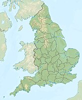
Peveril Point is a headland and forms the easternmost part of the Isle of Purbeck , a peninsula on the coast of County Dorset , on the south coast of England . Peveril Point is part of the town of Swanage .
At the top of the hill is a coast guard hut . Peveril Point is also the base of the Swanage Lifeboat Organization.
The headland contains underground tunnels. These tunnels connect disused gun emplacements that defended the west entrance to Southampton Waters during World War II.
The rocks of Peveril Point are made of slate as well as Portland and Purbeck limestone in a hollow structure. A stretch of coastline stretches from Orcombe Point , near Exmouth in the west, to the Isle of Purbeck in the east, and was the first natural landscape in England to be declared a World Heritage Site by UNESCO . Peveril Point is part of the Jurassic Coast , it is one of the natural wonders of the world and is known for its fossils .
See also
Individual evidence
- ^ Ward, Lock and Company, Ltd. & Hammond, RJW (1974). Complete England . London: Ward Lock, p. 94.
