Orcombe Point
| Orcombe Point, Devon | ||
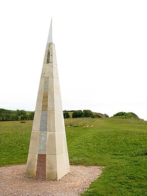
 The geoneedle at Orcombe Point near Exmouth |
||
| Geographical location | ||
|
|
||
| Coordinates | 50 ° 36 '24 " N , 3 ° 23' 8" W | |
| Waters 1 | English Channel | |
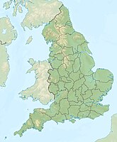
Orcombe Point is a headland near Exmouth on the south coast of England in the county of Devon . It separates the wide estuary of the Exe in the west from Sandy Bay in the east.
The steep coast of the English Channel in East Devon and Dorset is one of the natural wonders of the world. From Orcombe Point to Old Harry Rocks , a 155 km long coastline, the first country in the UK by extending UNESCO for World Heritage declared.
Orcombe Point is the starting point of the "walk through time", a hiking trail that follows the entire Jurassic Coast. There is the geoneedle , a kind of pillar in the shape of a pyramid, in the surface of which selected samples of different rocks of the Jurassic Coast are incorporated. The "Geo-Needle" was unveiled by Prince Charles on October 3rd, 2002 on the occasion of the World Heritage celebrations .
The Jurassic Coast rock strata tilts slightly to the east. The geologically oldest rocks are therefore in the westernmost section of this coastal geotope . The mean age of the rocks gradually decreases towards the east. The natural outcrops along the coast form a largely continuous sequence, ranging from deposits of the Triassic , through those of the Jura to those of the Cretaceous period, and represents a geological period totaling around 185 million years. The storage room that received the sediment series from the Jurassic Coast at that time is the so-called Wessex Basin .
The red rocks on the cliff at Orcombe Point consist of layers that are lithostratigraphically called "Exmouth Mudstone and Sandstone Formation" (roughly translatable as "Exmouth Clay and Sandstone Formation"), and which in turn form the "Aylesbeare Mudstone Group ”(“ Alyesbeare Tonstein Group ”). The Exmouth Formation consists of red-brown silty claystones in which lenses of red-brown sandstone are inserted, which were deposited in a river plain under semi-arid to semi-humid climatic conditions in the late Permian and / or in the early Triassic . The Exmouth Formation is closely related to some important Permian and Triassic sedimentary series in Central Europe, both in terms of its origin, its age and its petrography . B. with the Tambach formation of the Thuringian Forest or the red sandstone, which is widespread in Germany .
The sequence in the cliff at Orcombe Point is part of the type profile of the Exmouth Formation.
Cliff at Orcombe Point (the so-called Orcombe Rocks ) facing east, across Sandy Bay to Straight Point (on the horizon).
See also
Individual evidence
- ^ Dorset and East Devon Coast . UNESCO World Heritage Center. 2001. Retrieved October 19, 2010.
- ↑ a b Data sheet of the Exmouth Mudstone and Sandstone Formation in the British Geological Survey's online encyclopedia of named rock units
- ↑ Detlef Mader: Braidplain, floodplain and playa lake, alluvial-fan, aeolian facies and palaeosol composing a diversified lithogenetical sequence in the permian and triassic of South Devon (England) . In: Aspects of Fluvial Sedimentation in the Lower Triassic Buntsandstein of Europe. Lecture Notes in Earth Sciences . tape 4/1985 , 1985, pp. 15-64 , doi : 10.1007 / BFb0010515 .


