Old Harry Rocks
| Old Harry Rocks | ||
 Old Harry Rocks , Isle of Purbeck |
||
| Geographical location | ||
|
|
||
| Coordinates | 50 ° 38 '32 " N , 1 ° 55' 25" W | |
| Waters 1 | English Channel | |
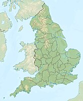
The Old Harry Rocks are two famous chalk pillars on the Isle of Purbeck peninsula on the coast of County Dorset , the south coast of England .
The Old Harry Rocks are 2 km east of Studland , about 4 km northeast of Swanage and about 10 km south of the towns of Poole and Bournemouth . Old Harry is a name for the devil.
The coast and cliffs along East Devon and Dorset on the English Channel are some of the natural wonders of the world. From Orcombe Point near Exmouth to Old Harry Rocks stretches 155 kilometers of coastline, which was the first natural landscape in England to be declared a World Heritage Site by UNESCO .
Orcombe Point is indicated by a geo-needle, it shows the starting point for the World Heritage Tour. The rock layers along the Jurassic Coast tilted slightly to the east. That is why the oldest part of the coast is found in the western area, progressively younger rocks form the cliffs here further east.
- See also: List of Places along the Jurassic Coast
Web links
Individual evidence
- ^ Dorset and East Devon Coast . UNESCO World Heritage Center. 2001. Retrieved October 26, 2010.
