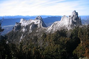
Pic de Bugarach
| Pic de Bugarach | ||
|---|---|---|
|
Pic de Bugarach |
||
| height | 1230 m | |
| location | Aude , Occitania , France | |
| Mountains | Corbières ( Pyrenees ) | |
| Coordinates | 42 ° 51 '49 " N , 2 ° 22' 45" E | |
|
|
||
The Pic de Bugarach or Pech de Bugarach ( Occitan Puèg de Bugarag ) is with its height of 1230 m the highest point in the Corbières , a low mountain range in the Occitania region in southern France. The Agly River has its source on the slopes of the mountain .
Whether the name of the mountain is derived from the village of Bugarach at a height of approx. 480 m at its foot, or vice versa, is ultimately not clear.
geology
The unusual shape of the mountain is based on a geological thrust ; the upper layers of the mountain are older than the lower.
Others
- During the survey to determine the original meter ( meridian expedition ) in the years 1792–1799, the mountain peak was an important trigonometric point for geographer Pierre Méchain .
- Esotericists and members of the New Age movement associate the Pic de Bugarach with UFOs , the Mayan calendar and the end of the world expected on December 21, 2012 .
Web links
Commons : Pech de Bugarach - Collection of images, videos and audio files
- Pic de Bugarach - Map and information (English)
- Pic de Bugarach, hike to the summit - photos + information
- Pic de Bugarach, hike to the summit - photos + information
Individual evidence
- ^ Formation des Pyrénées - accessed September 4, 2011
- ↑ Invasion of the Esoteric. In: Süddeutsche Zeitung. June 16, 2011.


