Piepersberg (Remscheid)
|
Piepersberg
City of Remscheid
Coordinates: 51 ° 9 ′ 49 ″ N , 7 ° 15 ′ 44 ″ E
|
||
|---|---|---|
| Height : | 338 m above sea level NN | |
|
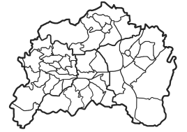
Location of Piepersberg in Remscheid |
||
Piepersberg is a court in the southeast of the Bergisch city of Remscheid in North Rhine-Westphalia .
Location and description
Piepersberg is located in the statistical district of Bergisch Born West of the Lennep district north of Bergisch Born on the watershed between the Eschbach and the Dörpe , over which the federal highway 51 and the route of the Wuppertal-Oberbarmen-Opladen railway ("Balkanexpress") runs. Other neighboring residential areas and courts are Buchholzen , Stöcken , Jägerhaus , Leverkusen and Bergerhöhe , Engelsburg , Heydt , Rademachershof , Eichenhof and Eichendahlerhof . Disposed of, Beeck .
The place can be reached via an access road that branches off from the main road.
history
Piepersberg was first mentioned in 1466 as Piepenßbergh and 1487 as Pipensbergh . The map Topographia Ducatus Montani from 1715 shows the farm as Pipersberg . In the 18th century the place belonged to the Bergisches Amt Bornefeld-Hückeswagen .
In 1815/16 36 people lived in the village. In 1832 Piepersberg was part of the Altbergian rural community of Fünfzehnhöfe , which now belonged to the mayor's office of Wermelskirchen . Which according to the statistics and topography of the district of Dusseldorf as Ackergut designated place had at that time five houses and two farm buildings. At that time, 34 residents lived in the place, two of them Catholic and 30 Protestant.
In the municipality lexicon for the Rhineland province , five houses with 37 inhabitants are given for the year 1885. At that time the place belonged to the mayor's office of Fünfzehnhöfe within the Lennep district . In 1895 the place had five houses with 28 inhabitants, in 1905 five houses and 38 inhabitants.
In 1906, the mayor's office was incorporated into the town of Lennep with Piepersberg, which was in turn incorporated into Remscheid in 1929.
Individual evidence
- ^ E. Erwin Stursberg : Remscheid and his communities, Remscheid, 1969, p. 246
- ↑ Johann Georg von Viebahn : Statistics and Topography of the Administrative District of Düsseldorf , 1836
- ↑ Königliches Statistisches Bureau (Prussia) (Ed.): Community encyclopedia for the Rhineland Province, based on the materials of the census of December 1, 1885 and other official sources, (Community encyclopedia for the Kingdom of Prussia, Volume XII), Berlin 1888.
- ↑ Königliches Statistisches Bureau (Prussia) (Ed.): Community encyclopedia for the Rhineland Province, based on the materials of the census of December 1, 1895 and other official sources, (Community encyclopedia for the Kingdom of Prussia, Volume XII), Berlin 1897.
- ↑ Königliches Statistisches Bureau (Prussia) (Ed.): Community encyclopedia for the Rhineland Province, based on the materials of the census of December 1, 1905 and other official sources, (Community encyclopedia for the Kingdom of Prussia, Volume XII), Berlin 1909.
