Heydt (Remscheid)
|
Heydt
City of Remscheid
Coordinates: 51 ° 9 ′ 57 ″ N , 7 ° 16 ′ 16 ″ E
|
||
|---|---|---|
| Height : | 330 m above sea level NN | |
| Postal code : | 42897 | |
|
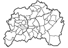
Location of Heydt in Remscheid |
||
|
Heydt
|
||
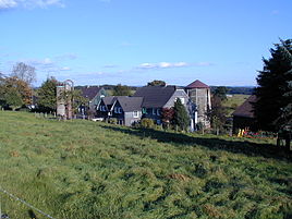
Heydt is a court in Remscheid in North Rhine-Westphalia (Germany).
Location and transport links
Heydt is located in the south-east of Remscheid in the statistical district of Engelsburg in the Lennep district and near the larger district of Bergisch Born . The place borders directly on the neighboring town of Engelsburg , other neighboring towns are Eichendahlerhof , Jägerhaus , Piepersberg , Bergerhöhe , Tefental , Oberlangenbach , Forsten , Lüdorf and Rademachershof .
history
The map Topographia Ducatus Montani from 1715 shows the farm as an o.Heid . In the early modern times, the Bergische Eisenstraße passed by the site, a regionally important transport route for pig iron from the Siegen area. The old road is marked on the topographia as Ÿſer-Stras .
In the 18th century the place belonged to the Bergisches Amt Bornefeld-Hückeswagen . In 1815/16 nine people lived in the village. In 1832 Heydt belonged under the name Heyd to the Lüdorfer Honschaft , which was part of the Hückeswagen external citizenship within the Hückeswagen mayor . The place, categorized as a hamlet according to the statistics and topography of the Düsseldorf administrative district , had two residential buildings and four agricultural buildings at the time. At that time, 14 residents lived in the village, all of whom were Protestant.
In the municipality lexicon for the Rhineland province , two houses with 13 residents are given for 1885. At that time the place belonged to the rural community Neuhückeswagen within the Lennep district . In 1895 the place had two houses with 13 inhabitants, in 1905 two houses and ten inhabitants.
In the course of the North Rhine-Westphalian municipal area reform (§ 21 Düsseldorf Act ), the eastern area around Bergisch Born with the Heydt farm was detached from the city of Hückeswagen on January 1, 1975 and incorporated into the city of Remscheid.
Individual evidence
- ↑ Erich Philipp Ploennies : Topographia Ducatus Montani (1715) , two volumes consisting of a book, ISBN 3-87707-073-6 and maps, ISBN 3-87707-074-4
- ^ Harry Böseke: Die Bergische Eisenstraße , ISBN 3-923495-71-4
- ↑ Johann Georg von Viebahn : Statistics and Topography of the Administrative District of Düsseldorf , 1836
- ↑ Königliches Statistisches Bureau (Prussia) (Ed.): Community encyclopedia for the Rhineland Province, based on the materials of the census of December 1, 1885 and other official sources, (Community encyclopedia for the Kingdom of Prussia, Volume XII), Berlin 1888.
- ↑ Königliches Statistisches Bureau (Prussia) (Ed.): Community encyclopedia for the Rhineland Province, based on the materials of the census of December 1, 1895 and other official sources, (Community encyclopedia for the Kingdom of Prussia, Volume XII), Berlin 1897.
- ↑ Königliches Statistisches Bureau (Prussia) (Ed.): Community encyclopedia for the Rhineland Province, based on the materials of the census of December 1, 1905 and other official sources, (Community encyclopedia for the Kingdom of Prussia, Volume XII), Berlin 1909.

