Pin (spiti)
| Pin code | ||
|
|
||
| Data | ||
| location | Himachal Pradesh ( India ) | |
| River system | Indus | |
| Drain over | Spiti → Satluj → Panjnad → Indus → Indian Ocean | |
| origin | north of Pin Parbati La 31 ° 50 ′ 5 ″ N , 77 ° 53 ′ 4 ″ E |
|
| Source height | approx. 4400 m | |
| muzzle | 18 km south of Kaza in Spiti Coordinates: 32 ° 5 ′ 40 " N , 78 ° 11 ′ 45" E 32 ° 5 ′ 40 " N , 78 ° 11 ′ 45" E |
|
| Mouth height | approx. 3450 m | |
| Height difference | approx. 950 m | |
| Bottom slope | approx. 19 ‰ | |
| length | 50 km | |
| Left tributaries | Debsa Nala | |
| Communities | Mud | |
|
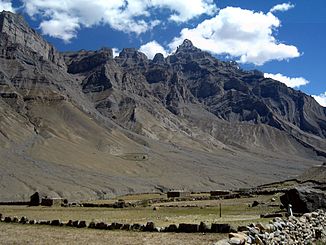
River valley of the Pin |
||
The Pin ( English Pin River ) is a 50 km long right tributary of the Spiti in the state of Himachal Pradesh in northwest India .
It rises in the West Himalayas in the Pin Valley National Park north of the Pin Parbati La pass . The river is fed by several glaciers. The Pin flows in a predominantly north-northeast direction through the south of Spiti . The only settlement on the river is Mud. In the lower reaches of the Debsa Nala flows into the river on the left. Finally, the Pin flows into the Spiti River 18 km south of Kaza .
