Polar air

Polar air is a cold, atmospheric current in the northern hemisphere that originates in the polar region and usually makes its way across the ocean to more moderate latitudes .
Definition and demarcation
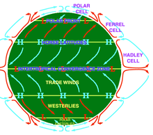
In weather reports for the northern hemisphere, especially for Europe, polar air is generally understood to mean cold air masses originating from polar latitudes , which mostly move south over sea surfaces and which then travel from Russia to Central Europe from low pressure areas from the north-east of the Atlantic . On the other hand, one speaks of subpolar air when the air masses come from the Iceland or Greenland area instead of the inner polar region .

Effect in Central Europe
On its way out of the polar regions over the comparatively warm water of the North Atlantic, the polar air absorbs a lot of moisture. This creates showers of snow and rain in the air masses, and often also strong gusts of wind . Characteristic are the cumulus zones, which appear between the dense fronts as loose "fleecy clouds" in satellite images. Here, enhanced cumulus cells ('reinforced cumulus zones', EC) show more abundant precipitation nuclei.
To Central Europe, maritime polar air often reaches over the North Atlantic and the North Sea . In winter it regularly ensures wet and cold weather. In the European low mountain ranges, polar air is the cause of large amounts of snow .
Individual evidence
- ↑ Enhanced Cumulus - Short summary. ZAMG, DHMZ: Manual of Synoptic Satellite Meteorology , on zamg.ac.at (accessed November 26, 2017).