Ponta Lalétec
| Ponta Lalétec | ||
| Geographical location | ||
|
|
||
| Coordinates | 9 ° 12 ′ S , 125 ° 40 ′ E | |
| coast | South Timor Coast | |
| Waters | Timor Sea | |
 Map of the municipality of Ainaro (administrative boundaries before 2015) with the Ponta Lalétec |
||
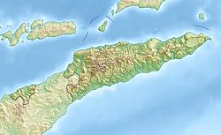
The Ponta Lalétec (also Cabo Cacetec ) is a cape on the south coast of the island of Timor . It is located in the East Timorese Suco Foho-Ai-Lico ( administrative office Hato-Udo ), in the southeast of the municipality of Ainaro . East of the cape, the Caraulun River flows into the Timor Sea, which forms the border with the Manufahi municipality .
Individual evidence
- ^ Timor-Leste GIS-Portal ( Memento from June 30, 2007 in the Internet Archive )
- ^ United Nations map of East Timor
