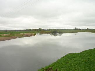
Pronja (Sosch)
|
Pronja Проня |
||
|
Pronja in Slauharad Rajon (Mahiljouskaja Woblasz) |
||
| Data | ||
| location | Wizebskaja Woblasz , Mahiljouskaja Woblasz ( Belarus ) | |
| River system | Dnepr | |
| Drain over | Sosh → Dnepr → Black Sea | |
| source |
Smolensk Heights 54 ° 27 ′ 4 ″ N , 30 ° 48 ′ 52 ″ E |
|
| muzzle |
Sosch coordinates: 53 ° 26 ′ 37 " N , 31 ° 0 ′ 43" E 53 ° 26 ′ 37 " N , 31 ° 0 ′ 43" E
|
|
| length | 172 km | |
| Catchment area | 4910 km² | |
| Outflow at the level at the mouth |
MQ |
30 m³ / s |
| Medium-sized cities | Horki | |
| Small towns | Slauharad | |
The Pronja ( Russian Проня ) is a right tributary of the Sosch in the east of Belarus .
The Pronja rises in the Smolensk Heights in the southeast of the Vitebskaya Woblasz . It flows mainly in a southerly direction through the Mahiljouskaja Woblasz . She passes the western outskirts of Horki . It finally flows into the Sosch on the right at the small town of Slauharad .
The Pronja has a length of 172 km. It drains an area of 4910 km². The snowmelt dominates the annual runoff of the Pronja. The mean discharge at the mouth is 30 m³ / s. In summer, heavy rainfall can lead to flooding. The Pronja is covered with ice between the end of November and the end of March.
