Puerto Angel
| Puerto Angel | ||
|---|---|---|
|
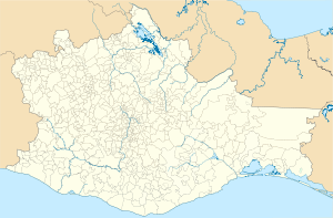
Coordinates: 15 ° 40 ′ N , 96 ° 29 ′ W Puerto Ángel on the map of Oaxaca
|
||
| Basic data | ||
| Country | Mexico | |
| State | Oaxaca | |
| Municipio | San Pedro Pochutla | |
| Residents | 2645 (2010) | |
| Detailed data | ||
| height | 50 m | |
| Website | ||
| Puerto Ángel - place and beach | ||
| Puerto Ángel - beach | ||
Puerto Ángel is a coastal town with approx. 3,000 inhabitants in the municipality (municipio) San Pedro Pochutla in the state of Oaxaca in southern Mexico . Together with the neighboring town of Zipolite and the Soconusco region in the state of Chiapas , it is one of the southernmost places in Mexico.
Geography and climate
The seaside resort of Puerto Ángel is about 10 to 100 m above sea level on the Pacific coast of the state of Oaxaca. The small town of San Pedro Pochutla is only about 15 km (driving distance) north; the city of Oaxaca de Juarez is a good 255 km to the north. The climate is tropical and warm; Rain (approx. 725 mm / year) falls mainly in the summer months.
Population development
| year | 2000 | 2005 | 2010 |
| Residents | 2,473 | 2,440 | 2,645 |
Most of the inhabitants come from the villages in the area; In addition to Spanish, there is also a few Mixtec or Nahuatl dialects.
Economy and history
Puerto Ángel was a small fishing village until the 19th century. From about 1855 to 1870, the port of the place became very important for the shipping of coffee from Chiapas along the Pacific coast; After the construction of a railway line from Salina Cruz to the Atlantic and the Mexican highlands in the 1880s, the place fell into oblivion. The partly idyllic Pacific beaches have been rediscovered by individual tourists since the 1960s. Today smaller pensions, restaurants, etc. determine the townscape; many people work in the tourism sector, but there are still some fishermen.
Attractions
The beaches of Puerto Ángel are among the most beautiful in Mexico.


