Pukará del Cerro de La Compañia
| Pukará del Cerro de La Compañia | ||
|---|---|---|
|
The Cerro Grande de la Compañia seen from the west. |
||
| Alternative name (s): | - Pukará de La Compañia
- Fortaleza Cerro Grande de La Compañia |
|
| Creation time : | 1310 (oldest date) |
|
| Castle type : | Summit castle | |
| Conservation status: | ruin | |
| Construction: | Quarry stone | |
| Place: | Graneros at Rancagua | |
| Geographical location | 34 ° 4 ′ 0 ″ S , 70 ° 41 ′ 0 ″ W | |
| Height: | 677 m | |
|
|
||
The Pukará del Cerro de La Compañia (meaning: Jesuit Mountain Fortress) is a historical fortress on an island mountain in the Chilean central valley near Rancagua . Built in the 14th century by the local indigenous population, the fortress was taken over by the Inca from the middle of the 15th century and expanded into a garrison and a regional supply center. The complex is one of the most southerly Inca structures.
description
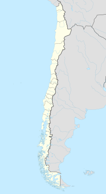
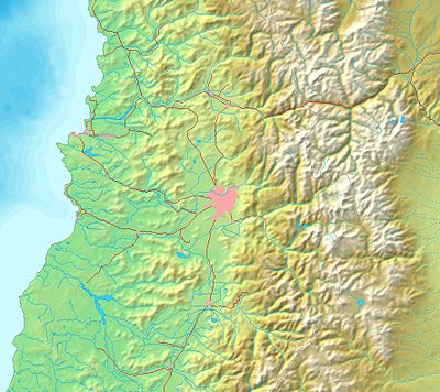
The Pukará is located on the Cerro Grande de La Compañía ( ), an island mountain in the Cachapoal plain, in the municipality of Graneros near Rancagua , around 90 km south of Santiago de Chile .
![]()
The mountain with a height of 677 m and an area of 60 hectares is characterized by various natural rock steps and a steep slope on its north side. It was surrounded by swamps and moors , which are now largely drained. The strategically favorable location includes optimal visibility in all directions. To the north, Angostura de Paine ( ) and the Chada Pass ( ) can be seen, over which roads lead to Santiago. To the south the view extends to Angostura de Rigolemo ( ). That is around 60 km in a north-south direction. In an east-west direction, the 20 km wide valley at this point can be overlooked in its entire width from the foot of the Andes in the east to the coastal cordillera in the west. The mountain is located on the Qhapaq Ñan , the historic long-distance traffic route that connected the region to the north with Cuzco , the capital of the Inca empire Tawantinsuyo, about 2300 km away , and leads south to the nearby southern border. It was also on an old road that connected the Andean highlands to the east and the coast to the west.
![]()
![]()
![]()
There are three stone wall rings at different heights. The first wall, at 672 m, the highest, closes the summit crest with 11 buildings and its central square over a distance of 120 m to the east and south, whereby it partially serves as a retaining wall . When it was discovered, it was 50 to 60 cm high with four rows of stones, the lower half of which was fixed with clay. The terrain slopes steeply to the north and west and did not need a wall. A 3.30 m wide passage is in the south. The second, middle wall ring at a height of 625 to 650 m, starting from the steep slope in the north, encloses the mountain top in a U-shape to the east, south and west. It consists of two walls, 440 m and 452 m long, separated by a 15 m gap. The third, lower wall ring at a height of 610 to 615 m runs approximately parallel to the second and also closes off the east, south and west sides. Two walls with a total length of 666 m have been preserved from it.
On the summit level there are eleven isolated buildings for residential and defense purposes, built in the so-called Inca provincial style. In other areas there are silos for storing food, so-called collcas .
history
Three epochs can be distinguished. The first and oldest epoch began with the development of the mountain into a fortress by the local indigenous population and ended with the military conflict against the Inca advancing from the north. The oldest possession of the mountain, proven by age determinations on ceramics, took place in 1310 AD. It is believed that the settlement can also be older. The most recent traces from this period are dated to 1450 AD. The residential buildings from this period have a circular floor plan. It is known that the local population, the so-called Promaucaes, used this fortress to defend themselves against the expanding Inca Empire.
| |
The second epoch began with the annexation of the region to the Kollasuyu, the southern province of the Inca Empire, and ended with the defeat of the Inca state by Spanish conquistadors. The Inca took over the fortress and expanded it into a garrison and supply center. The buildings, which assimilate an Inca style, are estimated according to ceramic dating to 1430 AD to 1530 AD. The Inca built a meeting place on the summit plateau within the highest first wall ring, some isolated buildings with a rectangular floor plan and round food silos (collcas). The Pukará was part of the Inca infrastructure in central Chile, as numerous archaeological finds show. At the time of the greatest expansion of the Inca Empire, its southern border was no more than 200 km away. Although there are references in historical sources to other fortresses and settlements located further south, in this region, apart from the Pukará de La Compañia, only the ruins of the Pukará La Muralla near San Fernando and a few settlements on the way to the Maipo Pass have been found .
The third epoch began with the Spanish conquest in Chile, when the Inca Empire had already been defeated with the conquest of the capital Cuzco and the execution of the Inca, and ended after a war that lasted for years with the submission of the local population to the Spanish colonial rulers. The Promaucaes defended themselves with the help of the fortress under the leadership of their chief Cachapoal against the advancing conquistadors, initially successfully in 1535 against a troop of Diego de Almagro and from 1541 against Pedro de Valdivia . In 1541/42 the fortress was captured by the Spanish for the first time. It was initially a Pyrrhic victory that did not bring any control over the population. The war then lasted for several years until the conquistadors succeeded in enforcing their rule.
The pukará lost its meaning. The mountain became the property of the Dominican Order and later the Jesuit Order . So the fortress, located in the middle of a heavily used and populated agricultural area, fell into oblivion. While Chilean historians always knew from known sources that there had been an important pukará near Rancagua, apparently no one knew the exact location. It was not until 1987/88 that topographical indications were found in documents of the Santo Domingo convent in Santiago, which enabled archaeologists to find and examine the fortress. In 1997, a path for vehicles was pushed to the summit for the construction of a cellular antenna system. Some of the fort's buildings were damaged or destroyed.
Web links
Remarks
- ↑ The name Cerro Grande de la Compañia , Spanish for large mountain of the company , comes from the colonial times when the mountain belonged to the extensive property of the Jesuit order , called la compañia for short (Spanish: the company, society). Before, when the area belonged to the Dominican Order , the mountain was also known to the Spanish as Cerro del Ynga (Mountain of the Inca). Today the area is called La Compañía .
- ↑ Promaucaes, promaucas or purumaucas, from the Inca language Quechua purum awqa, means "uncivilized people", "barbarians".
- ↑ Or also called Cachipoal.
Individual evidence
- ↑ Pukará del Cerro de La Compañia. Consejo de Monumentos Nacionales, accessed February 2, 2014 (Spanish).
- ↑ a b c d e f g h María Theresa Planella, Rubén Stehberg: Etnohistoria y arqueología en el estudio de la fortaleza indígena de Cerro Grande de La Compañia . In: Revista Chungara . tape 26 , no. 1 (Enero – Junio), 1994, p. 65-78 ( chungara.cl [PDF]).
- ↑ a b c coordinates according to Google Earth 2014.
- ^ Rubén Stehberg Landsberger: Instalaciones incaicas en el norte y centro semiárido de Chile . 1st edition. Ediciones de la Dirección de Bibliotecas, Archivos y Museos, Santiago 1995 ( memoriachilena.cl ).
- ^ A b Leonardo León: La resistencia Anti-Española y el rol de las fortalezas indígenas en Chile Central, 1536-1545 . In: Cultura, Hombre, Sociedad . tape 3 , no. 1 , 1986, doi : 10.7770 / CUHSO-V3N1-ART154 ( portalrevistas.uct.cl ).
- ^ A b María Teresa Planella, Blanca Tagle, Rubén Stehberg, Hans Niemeyer: Logros y fracasos en la etapa de recuperación de un patrimonio arqueológico e histórico vulnerado: El caso de la Fortaleza Cerro Grande de La Compañía . In: Chungará (Arica) . Revista de Antropología Chilena. tape 36 , September 2004, ISSN 0717-7356 , p. 1159-1174 , doi : 10.4067 / S0717-73562004000400050 .


