
Rancagua
| Rancagua | |
|---|---|
|
Coordinates: 34 ° 10 ′ S , 70 ° 44 ′ W
Rancagua on the map of Chile
|
|
| Basic data | |
| Country | Chile |
| Residents | 231,890 (2017) |
| - in the metropolitan area | 290,864 |
| City insignia | |
 |
|
| Detailed data | |
| height | 517 m |


Rancagua is a city in Chile . It has 231,890 inhabitants (as of 2017) and is the capital of the Región del Libertador General Bernardo O'Higgins .
geography
Rancagua is located in a fertile plain on the Río Cachapoal at 517 m and around 87 km south of the capital Santiago de Chile .
history
The Incas settled in a place called Copequén near Rancagua . This settlement was subordinate to the Inca in Cuzco . The conquistador Alonso de Córdova began producing clothing and other handicrafts in Rancagua early on. In 1580 it was decided to form a kind of city with the doctrine of Rancagua. A church was built and later a cathedral in the same place. By 1625 the number of Spanish settlers had already increased significantly.
1687 a descendant dies of Alonso de Córdova and 152 Native obtain land rights, the cacique 's Tomás Guaglen. In 1711 the Spaniards set up a small military base in the city.
In 1743 Juan Francisco de Arrechea began the systematic planning and organization of the urban area based on the model of the city of Santa Cruz . Governor José Antonio Manso de Velasco founded the city on October 5, 1743. The city rights were officially granted on July 29, 1749.
In the Battle of Rancagua , Spain won on October 1 and 2, 1814 over Bernardo O'Higgins and José Miguel Carrera .
In 1861 the city received a rail link to Santiago de Chile.
In 1875 the city had 4051 inhabitants.
Attractions
The Termas de Cauquenes , hot thermal springs with high levels of magnesium and potassium, are worth seeing .
The Lago Rapel is 90 km west of the city and is a huge reservoir with around 80 km². This is a great recreational area.
Pukará del Cerro de La Compañia is a historic fortress.
economy
The region around Rancagua is considered to be agricultural. Mainly grapes , apples , sunflowers , tobacco , tomatoes and corn are grown .
There are copper , silver and gold mines near the town . The El Teniente copper mine with its ghost town Sewell is the largest underground copper mine in the world.
The city lies on the Panamericana .
Image gallery

Regional administration in Rancagua

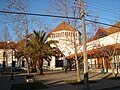
Paseo Independencia

cathedral
Instituto O'Higgins de Rancagua


sons and daughters of the town
- Germán Riesco Errázuriz (1854–1916), served as president of his country from 1901 to 1906
- Enrique Lobos (1887–1918), painter
- Alfredo Lobos (1890–1917), painter
- Alberto Lobos (1892–1925), painter
- Guillermo Saavedra (1903–1957), football player
- Hilda Sour (1915–2003), singer and actress
- Arturo Gatica (1921–1996), singer
- Lucho Gatica (1928-2018), singer
- Humberto Gatica (* 1951), American record producer, sound engineer and arranger
See also
Web links
- rancagua.cl (Spanish)