Pulau Pangkor
| Pulau Pangkor | ||
|---|---|---|
| Teluk Nipah Beach | ||
| Waters | Strait of Malacca | |
| Geographical location | 4 ° 13 ' N , 100 ° 33' E | |
|
|
||
| length | 12 km | |
| width | 4 km | |
| surface | 22 km² | |
| Highest elevation |
Bukit Pangkor 371 m |
|
Pulau Pangkor (formerly Dinding ) with its tropical sandy beaches is an important island for tourism . It belongs to the Malaysian state of Perak .
geography
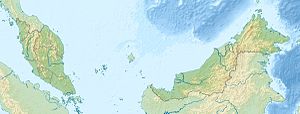
The island is located in the Strait of Malacca on the west coast of Malaysia . It is 12 km long and 4 km wide, about 22 km² in size and surrounded by several small islands, with Pulau Pangkor Laut in the southwest being the largest. The interior of the mountain, which is difficult to access, is home to the hornbill and is partly still covered with jungle . The highest point is Mount Bukit Pangkor at 371 meters. The western part of the island is developed for tourism with cottage settlements. In the northwest is the national airport Pangkor Island Airport .
history
The Dutch East India Company built an armed fort (Kota Belanda) in the south of the island in the 1680s , but had to leave it temporarily after attacks by locals in 1690 to protect the Dutch tin trade in the region from pirate attacks. It was rebuilt in 1743 and housed 600 Dutch soldiers. Five years later, in 1748, it was given up.
On January 20, 1874, Sir Andrew Clarke and Raja Abdullah signed the Treaty of Pangkor here , and the area became part of the Federated Malay States . This agreement had a decisive impact on the historical development of Malaysia.
Residents
Over 20,000 Malay, Chinese and Indian people live on the island in several small villages, so-called kampungs. The main town of Kampung Pangkor has a post office , bank and ferry to Lumut on the mainland.
The locals are known for their "fish satay" (Ikan Bilis), made from salted small fish that are dried in the sun. The wooden huts of the fishermen of Kampung Sungai Pinang Kecil and Kampung Sungai Pinang Bensar are built on stilts out into the sea and only connected to the mainland by wooden planks .
Locations from east to west:
- Kampung Pangkor (main town with ferry to Lumut )
- Kampung Sungai Pinang Bensar (ferry to Kampung Pangkor and Lumut)
- Kampung Sungai Pinang Kecil (Kali Amman Temple)
- Kampung Sungai Teluk Cempedak
- Kampung Sungai Teluk Dalam
- Kampung Teluk Nipah
- Pantai Pasir Bogak (2 km long beach on the west coast with bungalows)
- Kampung Teluk Gedong
- Kampung Sungai Teluk Kecil
tourism
Tourism is the main source of income for the island. Sights are the Dutch Fortress, the Fu Ling Kong Temple, the Pathirakaliaman Temple, the jungle in the interior of the island and various beaches.


