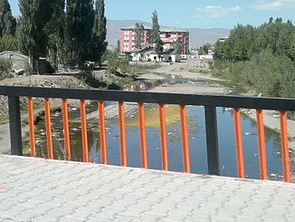
Pulur Çayı
| Pulur Çayı | ||
| Data | ||
| location | Erzurum Province ( Turkey ) | |
| River system | Euphrates | |
| Drain over | Karasu → Euphrates → Shatt al-Arab → Persian Gulf | |
| Headwaters | Tabye Dağı 39 ° 45 '46 " N , 41 ° 2' 26" O |
|
| muzzle |
Karasu coordinates: 39 ° 57 '28 " N , 41 ° 5' 21" E 39 ° 57 '28 " N , 41 ° 5' 21" E
|
|
| length | 43 km | |
| Catchment area | 526 km² | |
| Drain |
MQ |
2 m³ / s |
| Small towns | Aziziye | |
The Pulur Çayı (also Ömertepe Suyu ) is a left tributary of the Karasu in Eastern Anatolia .
The Pulur Çayı rises at Tabye Dağı west of Palandöken Dağı . It flows mainly in a northerly direction and finally flows 15 km west of the provincial capital Erzurum near Aziziye into the Karasu, which flows west. The Pulur Çayı has a length of 43 km. It drains an area of 526 km². The mean discharge is 2 m³ / s. There are repeated floods on the river .
